The Day the FCC Took Broadband out of the Right of Way

Communications infrastructure in right of way

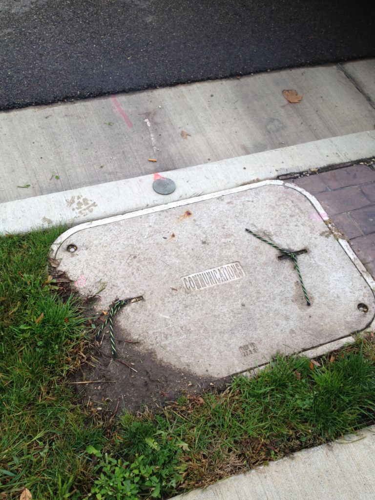
The use of public right of way is regulated by local or state government subject to local and state laws. Typically if a utility wants to install infrastructure in the public right of way, it must apply for and obtain a permit from the  government agency which has jurisdiction over the right of way. The installation and use of that infrastructure is then subject to the terms of that permit. Sometimes the issuance of the permit and the use is also subject to a franchise agreement negotiated between the local government and the utility. Utilities are also installed in utility easements which are designated on recorded plats of subdivisions. Private property owners typically own the underlying land which is subject to this easement. And the installation of the utillity in these easements is regulated by the local government through a permit and sometimes a franchise agreement. There have been additional regulations imposed through telecommunications acts. Often local government is restricted by these state or federal laws on the level of regulation that can be imposed on a public utility. Due to the telecommunications laws I have never heard of a use that was denied and instead have heard of court cases forcing cities to allow broadband companies to install their equipment in the right of way even when that installation was opposed by the city and the public.

Because the right of way and public utility easements are limited in area and because they are designated for public use, private parties are usually not granted permanent use of the right of way. Occasionally, limited uses are allowed such as street seating for restaurants or dog fences or sprinkler systems. In the case of use by a private entity, a legal agreement between the private entity and the local government is executed to permit the use. The local and state government has much more ability to charge fees and establish parameters for the use of public right of way when the applicant is not a utility or telecommunications company.

Keeping all that in mind, I can't help but wonder what will be the consequences of the FCC's net neutrality decision. From what I understand the premise of this action is the FCC is no longer going to define broadband companies as utilities and telecommunications. It appears instead the FCC's official position will be broadband companies are providing information services. Currently all of the major broadband companies have significant infrastructure in the right of way. Does this removal of a designation as a utility/telecommunication company mean local and state government can now regulate them as a private company? How about charge annual fees for use of the public right of way? And what about the infrastructure in public easements on private property? Is it legal for the company to keep its infrastructure in that utility easement? Can private property owners demand removal or payment? The next time a broadband company tries to install its Internet related equipment in my community, will the court again force the city to allow its installation as it did last time? Or since it's no longer a utility or telecommunication company, will the city prevail at denying the company access to the right of way?

With all the discussion online about the upcoming FCC decision, I've been surprised to see only one article touching on these issues and questions. The author of that article, "Ajit Pai's Net Neutraility Shell Game," suggested this reclassification will not take place and that this action by the FCC is only a ploy to force lawmakers into a position to concede even more power to broadband companies through additional telecommunication legislation. But if the FCC does end up moving forward with what they propose, I would expect eventually some local agency will test the legality of a broadband company's right to occupy the right of way. And if that litigation is found to have merit, permitting of right of way becomes a whole new playing field. 
Share

Augview – a Window to Your Underground Assets


Water Main Installation

Augview, founded by Michael Bundock in 2012 in New Zealand, is the first commercial, mobile application I have seen offered to the public works industry allowing utilities to geospatially capture, store, and display underground utilities in 3D through the use of a tablet or other mobile device. The software, through the use of GIS, will show operators their water, sewer, or other underground lines superimposed in 3D upon the ground in a geospatially accurate position. Users can then query the lines as with any other online GIS and access data about that utility such as size, material, age, and any other type of stored data. Or if a locator finds a discrepancy in a line's location or if he finds a new line, he can enter it into the software and immediately verify the updated or new location is accurate.

One example I can think of where I could have used this type of device was when we found a patched area in a roadway on one of our projects. It was one of those typical failures you find where you can see someone repaired something, but there's still something going on because a small hole opens back up with a void underneath. A lot of times this is caused by a hole in a sewer which allows soil above the pipe to wash away into the line leaving a void under the pavement. I knew the city had a sewer running along the roadway near that area, and I noticed a water shut off box nearby in the parkway. Because in our area the sewer lines used to be run with the water lines, I suspected it could be a failure with the building sewer. The business owner came out to comment on it and mentioned there had been a problem there, but it was difficult for me to tell for sure from what she explained if it had been the city sewer or the building owner's line. If I had Augview, I would have seen how all these lines related and where they were located. This visualization would have offered a better prediction of exactly which line could possibly have a failure. Of course public works professionals already try to make this determination using paper maps, but if it was the building owner's line, it is much easier to explain the problem to them using a 3D representation of everything rather than expect them to read a utility atlas.

I would have also liked to have an application like Augview for management of our water network. Our crews could have used the application to document the valve position when they opened or closed it. Then we could have just driven by to see if we had opened them all back up after we repaired the break, or we could have noticed when a valve between our pressure zones accidently was opened.

It would also be useful to use Augview to look at non-utility data for something like visualizing roadway ratings in the field. Then each year when we went out to rate the roadways, perhaps Augview could color the roadway based on the rating we assigned the year before in our GIS. This would prevent us from juggling paper maps in the truck while we are trying to also view and assess the pavement.

Past articles on this site have also imagined one day a product like Augview could be used to assist contractors as they build by displaying not only the underground lines but actually superimposing the plan onto the site. And I don't think it will be long before this type of implementation is extended to allow us to display real time data too. I can see one day we will be able to look up at the water tower and actually see the level of water in it or be able to see an indication at our water or wastewater plants of the flows running in and out and through each process. It would also be interesting to be able to drive by our lift stations and see the whole area colored red or green rather than just see the little red/green run light. This is also another facility that could display flows, seal failures, water levels or any other type of data.

While at the present time Augview has primarily been implemented in New Zealand, Melanie Langlotz,  business development manager, said she is "also looking for interested parties in the U.S. who can see the possibilities." So I believe it won't be long before we see Augview in use throughout the U.S. and other countries.

You can find out more about Augview by watching the video below or visiting their website or other social media sites:

Share

A Day in the Life of a Civil Engineer – Day 28

Day 28

Utility in our Right of Way with No Permit

Today I spent a little more time looking into the utility that was placed in our right of way with no permit. We went out into the field to measure how far off the road the concrete handholes were poured. For most of the length, the road has a rural section (no curb and gutter – only gravel shoulders). The edge of the concrete was 9", 12", and 18" from the edge of pavement at the three handholes. 

After looking into the property documents in that area, I also realized that the owner of the utility owns land north of the roadway so at least a quarter mile of the line could have been placed further off the road on their own property. Also, about another quarter mile was placed along right of way that is only for the use of roadway – not utilities. This is a common mistake unfortunately made by engineers who do not understand property ownership. What the engineer missed here is that in rural areas most land owners with property adjacent to roadways actually own to the center of the road. And the owners have given an easement to the public for roadway purposes only. So if you are designing a utility  like water mains or sanitary sewers and plan to have them installed in this apparent "right of way," you still need to arrange for the property owner to grant an easement for the utility because it has no relationship to roadway use. Of course, my supervisor and other staff members in our office realized this, but the consultant designing this project must not have.

So, I am not yet sure how this will all be resolved. We have set up a meeting to discuss it further.

Looking down on a weir in a restrictor

People Messing with Drainage

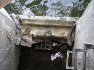
So after gathering more information about the permit issue, I spent some time with other staff members looking at a restrictor structure where someone had altered the height of the overflow. We aren't sure when this happened and only realized it after residents started complaining about failed flared end sections. One of our staff members figured it out by researching the subdivision plans which were dated in the 1970s then arranging to have some elevations taken on the structure. Through his efforts, he determined the height had been raised by about 6 inches which makes sense because as you look around the pond, each end section is submerged by about 6 inches. The person who raised the weir seems to have done so by trying to first use concrete blocks and then placing wood wrapped in a rubber membrane. You can see the result of their work in the photo to the left. This is a view looking down from the top of the structure. After a few of us visited the structure today, we came up with a solution of cutting the wood down to the design height. This allows us to quickly resolve the situation with minimal cost and disruption. We still are surprised that someone would take it upon themselves to raise the design level of a retention pond in a subdivision.

Inlet Removal and Replacement

Later in the day, I met with a contractor who was going to pave around an inlet we removed and replaced earlier in the year. We had done this to help encourage water to flow into this inlet rather than continue to travel down the road and down properties lying adjacent to and sloping away from the roadway. Unfortunately our work will not allow for the capture of all the water flowing down the road and onto the properties. But since the properties along the road slope down from the road at a significant grade to a creek, there's only so much we can do to keep the water completely on the road.

Developments and Parking Lots

At the end of the day I had the opportunity to participate in a discussion with a developer about some property in our city. It was a great meeting, and because the developer knew a lot about our city, I was able to learn many things. Later in the evening, one of our staff engineers and I attended a planning commission meeting. The group was considering our request to change zoning on a specific parcel in our downtown and allow for the use of a parking lot in that same block. After the project engineer testified and explained our project, the commission asked questions about the project then approved our request. This will now go forward for council consideration and hopefully approval.

Share

A Day in the Life of a Civil Engineer – Day 24

Day 24

Backhoe

Safety Meeting

Today was the first Thursday of the month and that means safety meeting day! The whole public works staff attends the monthly safety meeting, and the topic today was backhoe safety. If I get a chance I'll put up a post on it later this week because it was interesting and probably would make a good article.

Cemetery Maintenance

After learning about how to safely operate and transport backhoes, we met with someone who provides cemetery services. Right now we have one person who is responsible for all the maintenance in the two cemeteries we own. We do have some summer help, but there's still a lot of work to be done. And when our help goes back to school, we are back down to one person. Several members of the public have indicated they want increased maintenance services so we are looking at ideas for meeting their requests. One idea is to bid out the maintenance and see if it is cheaper to hire it out than use staff members. During the meeting today we learned about what services companies provide and what other cemeteries they take care of. At this point we are just researching. Our city council will have to make the final decision on whether or not we bid this out or continue to use staff.

Overweight vehicles

Something strange did happen during the morning. Someone called me to complain about getting a ticket from our police for having an overweight vehicle. He also wanted to ask me several questions about this. It was a little difficult answering all of them because our office only handles issuing permits for overweight vehicles. The police enforce the overweight vehicle limits on our streets. I did read him the ordinance explaining we do not allow any trucks over 6 tons on roads unless indicated otherwise and told him the ordinance was available online. So he paraphrased what I said to mean that he, as a landscaper, was not allowed to provide services to residents in our community. I tried to explain this was not what I said and that he could solve the problem by distributing his load between two vehicles to get it below 6 tons and that I've seen other companies doing this. But he did not seem to think this would be an option. I also tried to suggest taking his setup to a truck scale and working with the loading to get it below 6 tons. But he didn't know where a scale was and having only been here for two years, I wasn't sure where the closest one was either. 

He also asked many more questions that were more related to how the police ticket and how they determine when a load is overweight, but I could not answer him since we do not deal with that in my office. He was also frustrated because he must have called other cities and they gave him information that was different from what we were giving him. I tried to explain every city has different ordinances so that's probably why he was getting different answers from different cities. I offered to find out how we could issue him an overweight permit so he could legally drive his load on the streets, but he didn't want me to ask about the process. He kept suggesting we are only issuing tickets to drive up revenue, and he said it was a stupid law. Then he got angry and hung up on me.

Emergency Utility Work

Then right before lunch I received a call from a utility company asking for verbal approval to perform an emergency repair in our downtown. These make me nervous because it's difficult to quickly assess the situation and think of everything that needs to be determined in order to proceed with something like this. But the person said the work would only be in the parkway and was desperately needed because the whole area of the city south of the downtown had no service. So after he promised to be safe and use proper traffic control and restore the area within a couple days, I told him it was ok to proceed. After I got in from lunch, one of the engineers asked me who gave approval for a utility to bore under the railroad. What? I explained what I had given approval for. Then one of the other staff members and I decided to go visit the work site. Meanwhile the person who had asked for the approval called back and said he had no idea it was going to go under the railroad. So he agreed to meet us there. In the end, it all worked out. They ended up calling the railroad, and two guys from the railroad showed up to flag and assist. Our locator marked out what he needed to locate. And they started digging. Because I had to deal with all this, I ended up missing a meeting with a landscaper for our parking lot, but the project engineer was able to go instead.

Rating the Roads

Then we all finished up the day checking out the road conditions in the next area of town to be inspected. 


Share

Setting Sustainable Water Rates

Water Distribution

Raising water or sewer rates is never a popular move, and in this economy many have tried to avoid it as if they are fleeing from a zombie apocalypse. But for many utilities expenditures are exceeding revenues, and there's sometimes little choice other than a rate increase. You can only cut so much from a budget before negatively impacting service levels and quality. But is this an unavoidable consequence of a bad economy? And can rates be set to sustain a utility even during times like these? Let's explore the history of rate structure, how it has impacted us today, and some solutions for going forward.

History of Water Rate Structures

In the U.S., there have been basically three types of structures or a mixture of two of the three:

  1. Uniform rates
  2. Increasing rates based on usage
  3. Decreasing rates based on usage

Some utitlities also applied a fixed fee in addition to the rate, but often this was not a significant amount. Water systems also created categories of users sometimes applying different rates to different users. Of the three structures listed above, number three was usually the more popular. After all, water was everywhere! And this was particularly true for cities with a large manufacturing base dependent on water for their process. It was almost as if utilities were begging people to consume water.

Based on stories I've heard from the "old timers," back then the water fund was never out of money. And they could always depend on it to carry the other funds. So what happened?

Water Rates & Water Funds Today

Our country has over the last couple decades transformed their view of water as an unlimited supply. Yes, water never really goes away, but it can become increasingly contaminated or placed into a state that costs significantly more to collect and improve its quality. So our view of water has changed to that of a valuable resource and commodity. And to encourage customers to conserve water, many utilities have changed rates to increase as water usage increases. At the same time, water regulations have significantly increased and only show signs of becoming even more stringent. The net result of all this is people using less water (yay! our conservation methods worked) causing a decrease in revenue (boo! we didn't see that coming!?) and the cost to collect, treat, and deliver water has skyrocketed causing an increase in expenditures. Then on top of that we had the recession with people cutting back even more on water just to save money or leaving behind vacant homes that generate no revenue for utilities.

Of course as they say hindsight is better than foresight. But it's surprising to me how many want to cling to the old ways going forward. Even as revenue is dropping and funds are bleeding, they continue to propose the old water structure of a decreasing rate based on increased usage. And many times with no fixed rate or a very small rate attached. This is simply not sustainable.

Implementing Sustainable Solutions

So what does work? This post cannot begin to offer the right answer for every situation. A good water rate study needs to be customized for each utility. But in general, a good beginning is to look at costs. Fixed costs that are truly independent of water usage need to be separated from costs that fluctuate with water usage. For example, if your water utility has two trucks, it has two trucks. If you normally pump 2 MGD and you change to pumping 1 MGD, you don't get rid of one truck if you still need two for checking your fixed system. Variable costs will include such things as chemicals and electricity.

In addition to costs, you need to look at your users. If you have categories of users such as residential, commercial, and industrial, these need to be analyzed as a group breaking each into usage blocks that make sense. It's also important to get a handle on the amount of usage expected throughout the year, particularly if seasonal temperatures fluctuate.

As you develop a good idea of water consumption in your system, you can start to explore which rate structure works best for your community. The community's philosophy on water consumption must also be taken into account. For some, a single rate independent of usage might best address the philosophy and the usage patterns. Because of water conservation efforts, some communities might choose to assess higher rates for increased usage. I can't imagine too many sticking with the less cost for more usage because this becomes a type of subsidy if source and treatment costs are high enough.

For many, it makes sense to meet variable costs with these rates and then add on a fixed fee that will pay the fixed costs. Doing anything other than this requires the rate to cover some of the fixed costs and puts the risk back on the utility because now the utility is dependent on water usage to be high enough to bring in extra money for fixed costs. It's also common to address low income populations or customers with minimum usage by offering a flat rate for the lowest tier of usage.

Although all that might sound straight forward enough, the real challenge occurs near the end of the analysis when you figure out what you really should be charging. Few utilities could probably implement the structure they really need immediately. One piece of advice is to set a target structure and then create a transition plan to get there. And whether you need to transition or not, it's best to create a long term ordinance establishing regular rate increases every year or every other year. This spreads the transition over a long time period and it allows for regular increases but offers elected officials the opportunity to amend an increase for specific years if possible.

Below is a guidance document from the EPA that can be used to assist in conducting a water rate study. And you can also find some good resources through AWWA publications.


Guide Small Systems Final Rate Setting Guide


Share