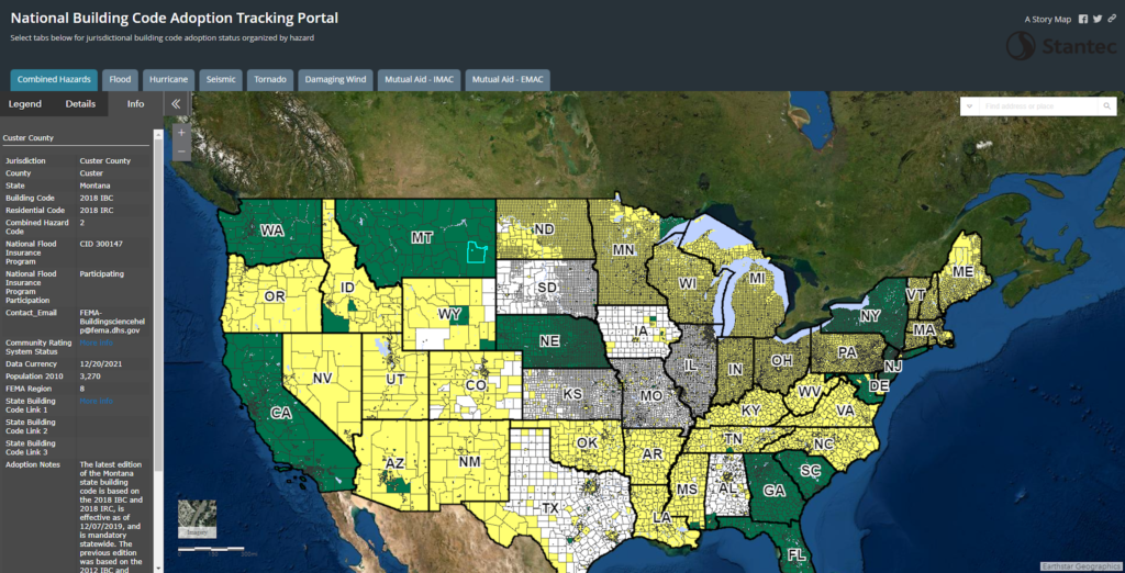
In a blog post the other day I shared information about the No Code No Confidence website where people can put in their zip code and find out the status of building codes in their area. Today I am going to introduce a similar site called the National Building Code Adoption Tracking (BCAT) Portal. According to FEMA which hosts the site, the BCAT Portal is an interactive WebGIS map that tracks five hazards (flood, seismic, tornado, hurricane wind, damaging wind) and displays:
- Code adoption information for Census Incorporated Places
- Additional metadata such as the latest decennial U.S. Census population and National Flood Insurance Program Community Identification (CID) number
- Mutual aid layer displaying mutual aid laws
- Regulations information from the annual Mutual Aid for Building Departments fact sheets
- High risk areas and code adoption and weakening information for each individual hazard, or view a comprehensive combined hazards layer
People can use the map by clicking an area and then reading information about the community at that location. The information is displayed in a separate window on the left side of the screen as shown in the image at the top of this post. I’ve also embedded the portal at the end of the post so you can access it just by clicking on it.
In the example in the image, I have clicked on Custer county, Montana. You can see in the image the information that came up shows the county has adopted both the 2018 International Building Code (IBC) and the 2018 International Residential Code (IRC). The county’s CID number in the National Flood Insurance Program (NFIP) is also displayed along with the county’s status in the NFIP which is participating. The population of the county based on the census is shown too. If you click the “State Building Code Link,” it will take you to the state website which offers information specifically about building codes in the state. In Montana, the agency which oversees building codes is the Business Standards Division. Each state regulates building codes, permits, licensing, and training differently so it’s important to check out the specific requirements in the state in which you live or work.
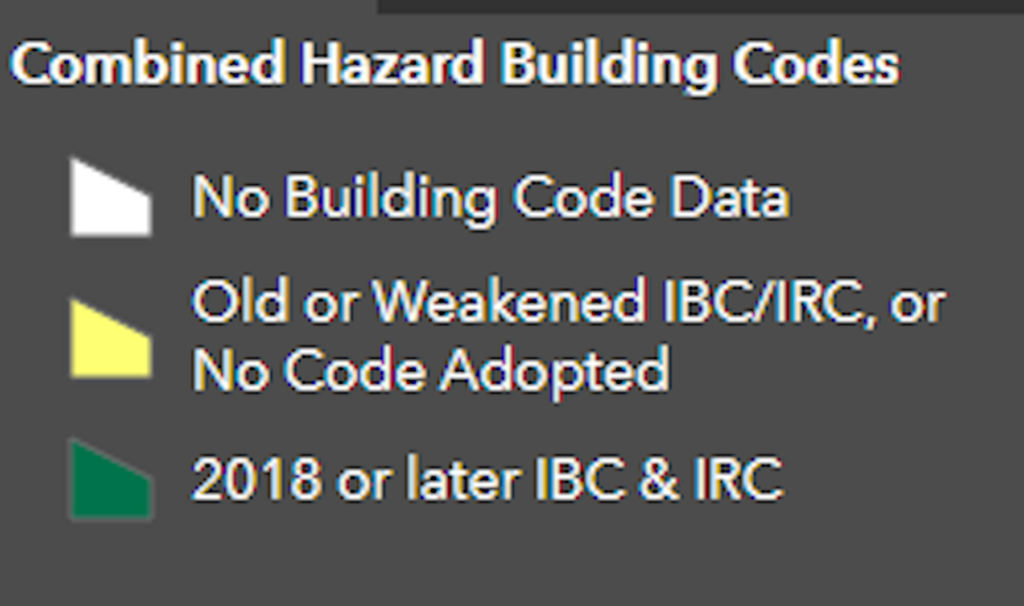
The BCAT Portal applies a color to each area based on the level of code adoption in that community. The legend below shows what each color means.
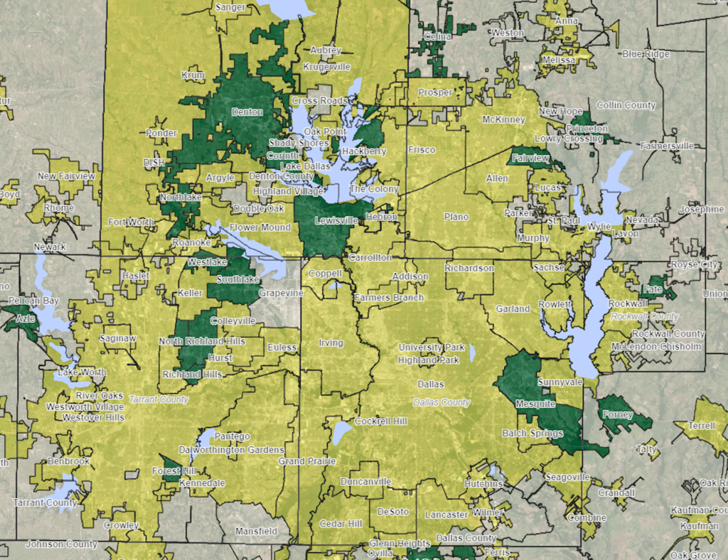
When zoomed out, the colors are applied at a county level. If you zoom in the colors are instead applied to the communities within the counties. I’ve included an image that is zoomed in around the Dallas area so you can see an example of how the colors change to show community adoption status when zoomed in.
If you are focused more on protection from specific hazards you can click on the tabs at the top of the map which highlight different hazards. The two mutual aid tabs show information regarding Emergency and Incident Management compacts.
