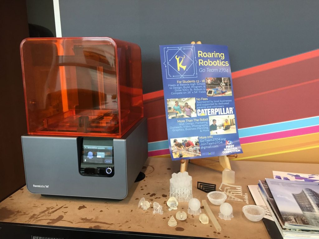
3D Printing for Civil Engineers

3D Printer

3D Printer
3D printer
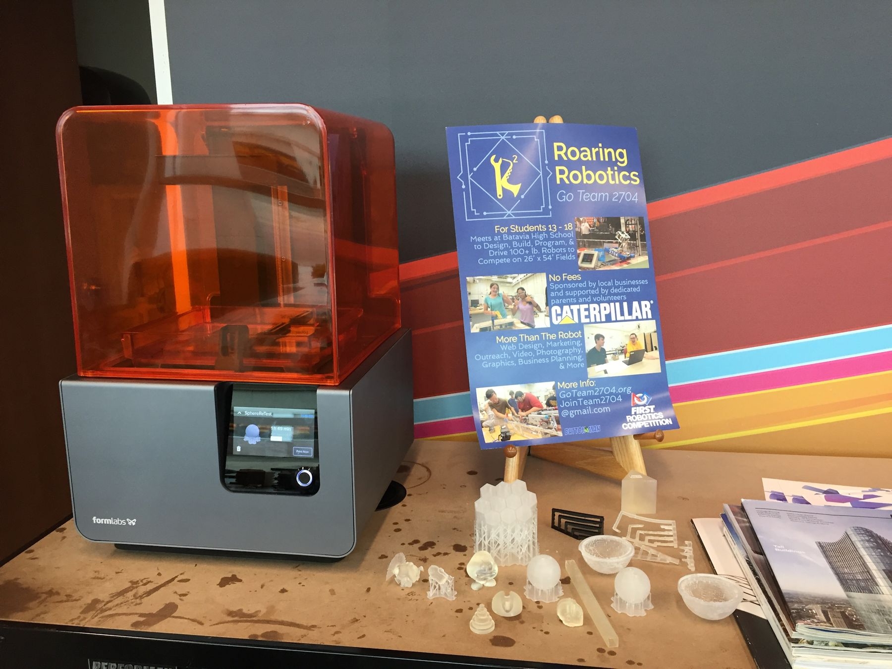
Lately I've been thinking our field might be missing out by not exploring the opportunities offered by 3D printing. Even though 3D printers have been around for many years, I haven't seen anything significant related to its use by agencies or firms in our field. I remember a 3D printer in use in a classroom at the college where I used to teach and that was at least 13 years ago. But that printer was used by the mechanical drafting students – not those in the civil technology field. So my partner and I have embarked on the goal of learning more about 3D printing and how the technology can be used in the civil engineering field.

Fortunately we found a learning program hosted by the University of Illinois in Champaign-Urbana which also happens to be our alma mater. The program is offered through Coursera and is a series of 5 courses leading to a specialization certificate in 3D printing. We began the first course right at the start of 2017 and are almost finished with the second one. So far the content has provided a good introduction to 3D printing and offered ideas about how it has been and could be used in many different fields.

Near the end of the second course, we were introduced to Josh Ajima, a teacher in Northern Virginia. In his presentation, he described how he created 3D representations of the earth's topography to visualize how different areas of a watershed relate. A description of his work with fabricating the Chesapeake Bay Watershed can be found in his article, "Design Challenge: Chesapeake Bay Watershed." Civil engineers can see right away how 3D printing an area's topography can lead to better understanding of watersheds, flooding impacts, material transport, and other related concepts.

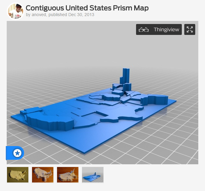
Then, in our effort to learn more about the local 3D printing community, we attended a workshop at the Maker Lab in the Harold Washington Library in Chicago. There we saw a printout of the topography of the bottom of Lake Michigan. We were also introduced to the idea of using 3D printing to display data. An example of this type of use can be found on a 3D printing site called Thingiverse where the user anoved has uploaded a model of the United States to be used to visualize data sets for the states. A screenshot of anoved's Thingiverse page with the map is shown below. We can imagine an agency using this model for public education to show the amount of transportation funding spent by each state or the number of highway fatalities or miles of roadway.

Thingaverse Example of US 3D printed map with data

I'll continue to share our experiences with 3D printing as we learn more about the technology and increase our understanding of how it might fit into civil engineering. In the meantime, if you are interested in learning more, I'd encourage you to check out the classes on Coursera – they are free to take if you are not interested in earning a certificate for the specialization. You can also visit Maker Labs in your own areas – they are usually found in most larger cities, particularly in libraries. Also, if you know of any uses of 3D printing in our industry, we'd love to hear about them – just drop us an email, comment below, or reach out to us on social media.
Share

Mapping the Accessible Path

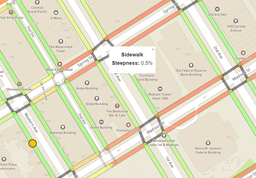
Access map screenshot showing sidewalk steepness at 0.5%

Access map screenshot showing sidewalk steepness at 0.5%The Data Science for Social Good (DSSG) team, a group out of the University of Washington, has been involved in an effort to improve mapping of the pedestrian way. By making use of the work from the OpenSidewalks project, they created AccessMap – a trip planning tool for people with limited mobility. With this tool, people can find the most accessible path through a network of sidewalks connected by curb ramps and street crossings.

At this time, the tool has only been implemented in Seattle, but the group plans to expand to other locations. The data used for the project is a compilation of the following elements with sources noted:

  • Base map – OpenStreetMap (OSM)
  • Sidewalks and curb ramps – Seattle Department of Transportation
  • Street crossings – DSSG Team
  • Elevations – National Elevation Dataset, USGS

When a user clicks a sidewalk segment, the steepness or grade is displayed. The screenshot of the map above shows a sidewalk segment along 1st Avenue between Madison and Spring streets at a 0.5% grade. Sidewalk segments are also colored coded to indicate the grade with red exceeding the required 5%, yellow just below the requirement, and green meeting the requirement. Clicking a street crossing or crosswalk displays the steepness or running grade along with a "Yes" or "No" to indicate whether or not curb ramps are at the corners.

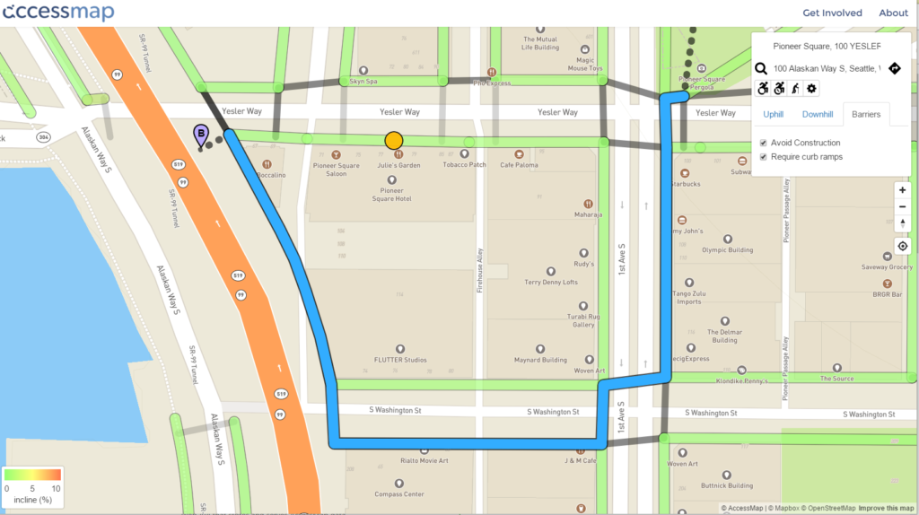
To plan a route using the map, the user types in their origin and destination in a manner similar to how other mapping programs work. The difference is that Accessmap has a drop down tool for the user to designate a limit for maximum uphill and downhill grade and the need to avoid construction and require curb ramps. Different mobility assisted devices such as wheelchairs or canes can also be designated. Below is an example of a planned route.

Planned route example on accessmap

Share

Who Should Pay for Clean Water?

WaterfallThere's been an ongoing legal dispute in Iowa between the Des Moines Water Works (DMWW) and drainage districts in three Iowa counties to decide who should pay the price to clean up polluted water. It's an interesting case for those of us who are involved in stormwater regulation and water treatment. And it is one more step in the ongoing struggle to determine how best to protect the environment and who is best positioned or most responsible to pay that cost.

Background on the DMWW Case

According to the final ruling document (No. 16-0076), DMWW "is a municipal water utility … that provides drinking water to an estimated half-million Iowans in the Des Moines area." Their water sources are primarily the Racoon and Des Moines Rivers. The watershed for the Racoon River is about 2.3 million acres in size and spans 17 counties in Iowa. DMWW stated in their complaint filed in federal court that "from 1995 to 2014, nitrate concentrations in the Racoon River at the DMWW intake points exceeded the 10 mg/L standard for drinking water at least 1636 days, or 24% of the time." Example concentrations mentioned in the complaint are 11.98 mg/L, 13.23 mg/L, 11.89 mg/L, 13.43 mg/L, and 12.56 mg/L. Therefore in order to provide water to its customers that meets drinking water regulations, DMWW incurred costs at its three treatment plants to reduce this level below the standard. DMWW also noted the need to expend funds in the near future to construct a new facility to handle the continuing elevated levels of nitrate.

In an effort that appears to force a reduction in or capture of these costs, DMWW filed a petition in federal court on March 16, 2015 (Trial Case No. C 15-4020-MWB). According to the Order Certifying Questions to the Supreme Court, the complaint basically alleges the drainage districts, or defendents, are "responsible for the increasing nitrate concentrations in the Racoon River." And because DMWW provides water to its customers from this river, which now has elevated levels of nitrate, it must incur costs it would not otherwise have to in order to reduce these concentrations below regulated standards.

On the defendent side, the drainage districts argued they were not the proper party for this lawsuit. They also indicate that other agencies of the state and federal government are responsible for regulating these matters – not a court of law. In the end, their bottom line was  "the existence and functions of drainage districts are so limited, the Iowa Supreme Court repeatedly, for over a century, has found districts not amenable to suit for damages, i.e., they are entitled to unqualified immunity."

Court Ruling in the DMWW Case

As reported in the online article of the Des Moines Register on Jan. 27, 2017, "the Iowa Supreme Court ruled that Des Moines Water Works cannot win damages under the Iowa Constitution against drainage districts in the three counties it is suing." The article includes an embed of the ruling in case anyone is interested in reading the court's explanation for each count of the complaint. The article also mentions there will be another ruling in June of this year to decide if drainage districts should be considered polluters under the Clean Water Act and subject to those regulations including the need to obtain permits for their discharges.corn


Why does this matter?

Water receives contaminants from natural and man-made activity, and removing those contaminants is not free. In the end, someone has to pay the cost, but who? In the Des Moines area, the cost to remove contaminants to provide safe drinking water is currently paid for by the DMWW which most likely passes the costs onto its customers. If the city subsidizes its utility for this purpose then the taxpayers of the city are also paying. But the people paying for that cost are not directly responsible for putting nitrates in the water. Instead studies show elevated contaminants in receiving streams are primarily a result of agricultural operations. (An earlier article in this blog cites a report indicating results of this in Illinois). So should agricultural operators pay the costs to remove contaminants?

Who pays is really what is being decided by lawsuits like the one brought by DMWW. In that case the court's decision leaves those using the water to bear the costs. Whether that is because of the manner in which the complaint was written or the specific defendents named, I cannot really comment on since I am not a lawyer. Articles and opinions I've read on the case indicate the matter is best left to legislators and regulatory agencies. What does seem obvious to me is no matter which entity pays, the cost will always ultimately be passed along to the end user. So whether it is the water or stormwater utility paying or the farmer, it seems we will pay for it through increased water bills to treat our water, taxes to clean our waterways, or grocery bills for increased costs for food production. So really the question should perhaps be How Do We Want to Pay for Clean Water?


Share

Gamifying and Crowdsourcing ADA Inspections

Project Sidewalk Mission Summary

The Makeability Lab at the University of Maryland is on a mission to "collect street-level accessibility information from every street in the world and enable design and development of a novel set of location-based technologies for accessibility." In order to achieve this goal, they set up an interactive website where people can inspect, identify, and label accessibility issues along sidewalks and at curb ramps.

The accessibility issues generated by this site are fairly basic, but would still be very helpful to cities interested in quickly and easily identifying issues. Currently the site is focused on auditing infrastructure in the Washington, D.C. area.

The group also plans to use the inspection data collected to "create new types of map-based accessibility tools, such as AccessScore, an interactive map of a city's accessibility, and RouteAssist, personalized routing algorithms based on a user's reported mobility level."

In addition, they are using the labels people assign to issues to develop algorithms to allow the computer to automatically find accessibility issues in the future.

So far 218 people have inspected almost 400 miles or 37% of Washington, D.C. If you are interested in volunteering your efforts, you can visit their website at http://sidewalk.umiacs.umd.edu and click on the "Participate" button.

Project Sidewalk Participate Screen

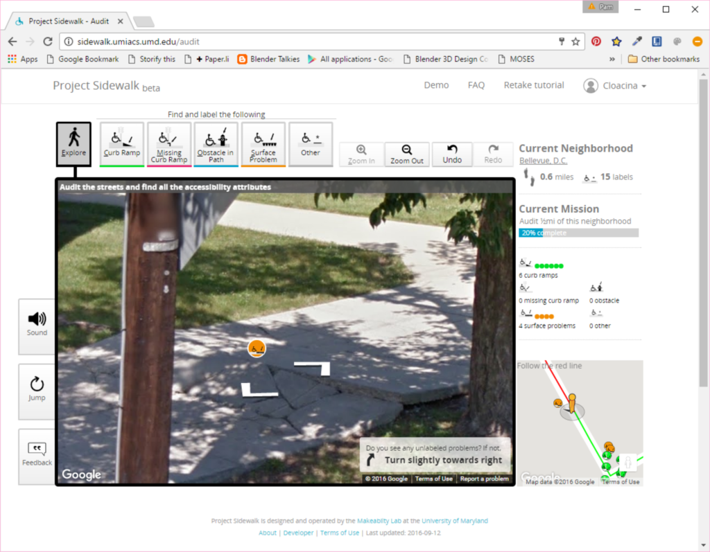
 Before beginning, you'll be offered a quick tutorial. You can also create an account to track your contributions. Here are a few screenshots taken while I inspected about a half mile of sidewalk in the Bellevue neighborhood of Washington, D.C. The first shows a section of heaved and cracked sidewalk I labeled as a surface problem. You can see I was able to choose this option from the group of issue icons located above the street-view image.

Project Sidewalk Surface Problem

When you place an icon on the image, a box pops up as shown in the screenshot below to allow you to choose the severity of the problem. The site gives some guidance on this, but there is still a lot of judgment in assigning a rating. Initially I wasn't going to give this specific problem the worst rating, but then decided the slope looks severe enough I don't think a wheelchair would safely navigate across the heaved section. Below the rating, there is a space for a more detailed description of the problem.

Project Sidewalk Surface Problem Rating

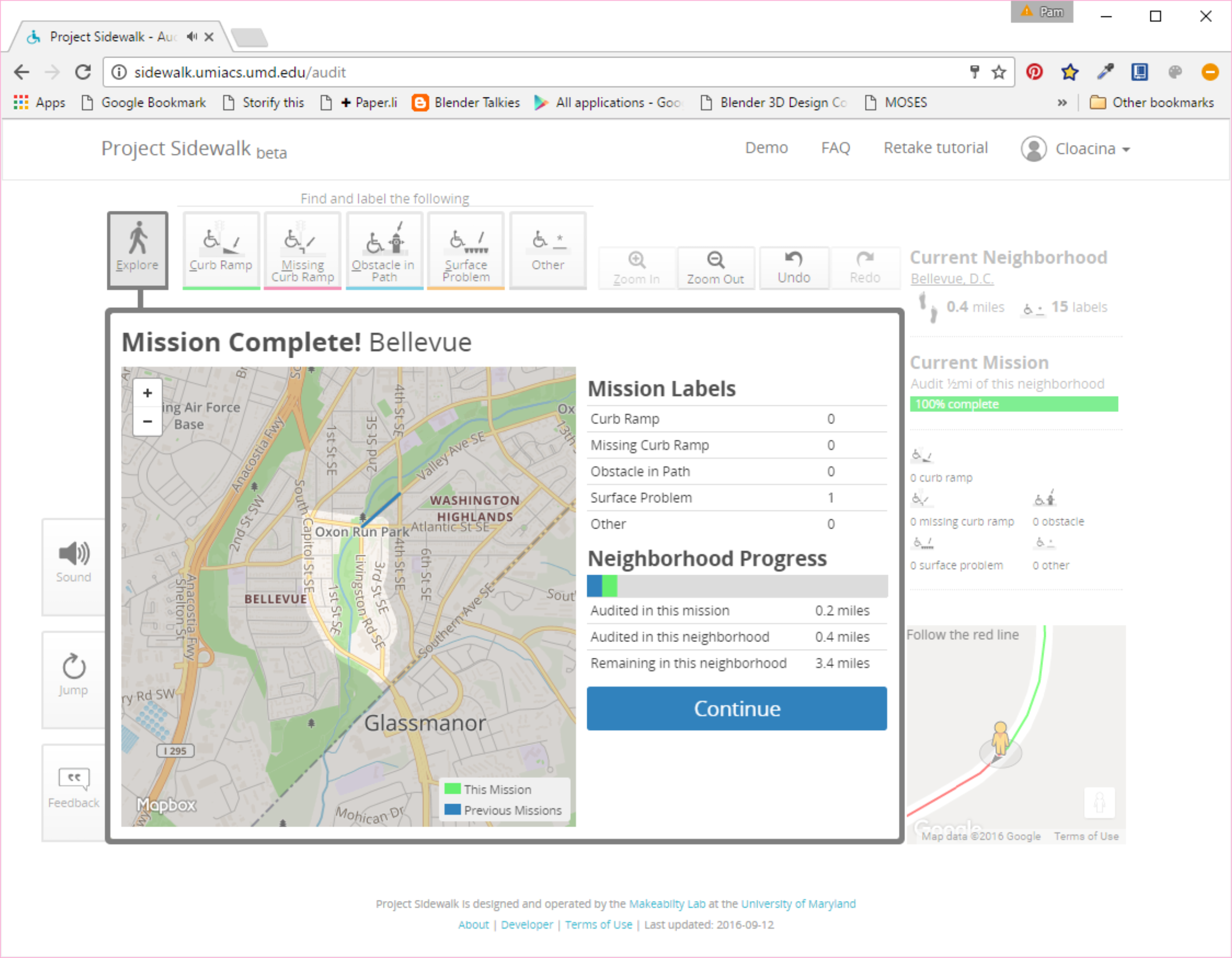
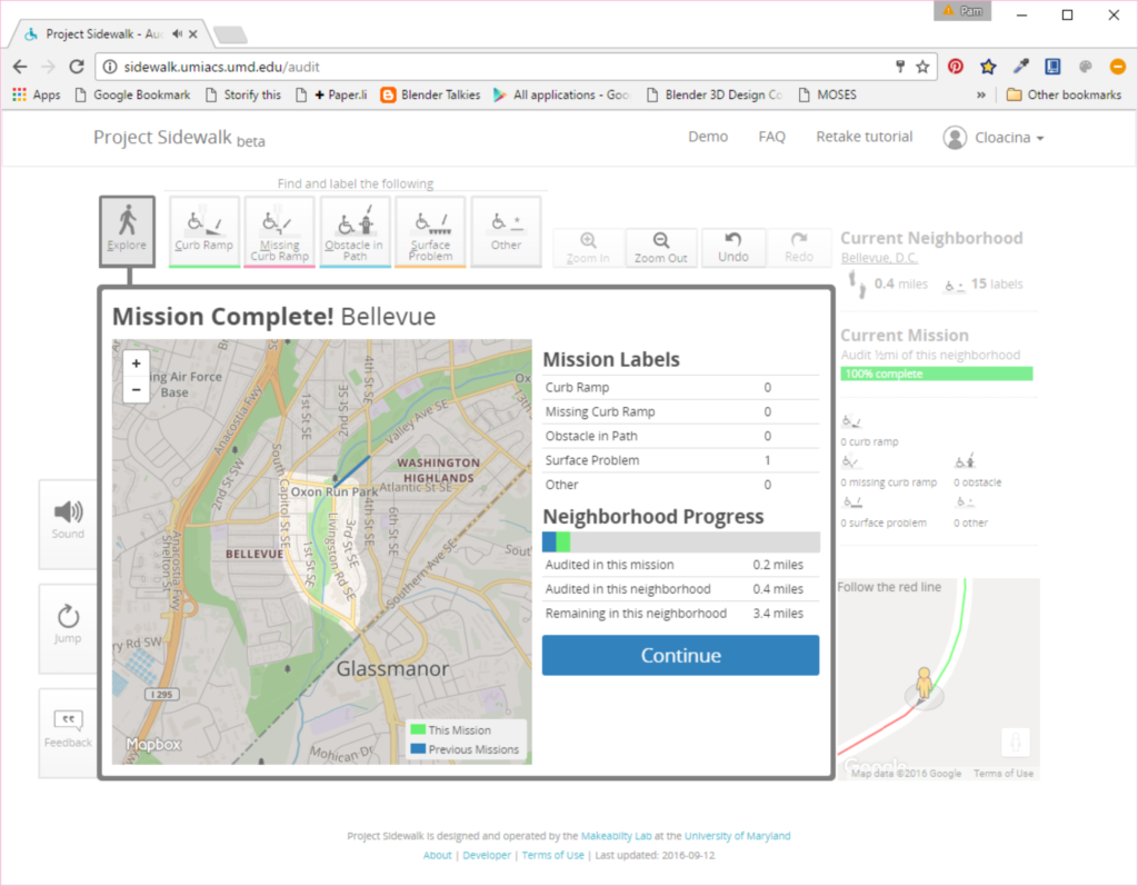
The screen also shows which neighborhood I am in, where I am at on the street, how many miles I have audited and labels I have placed. As you complete assigned sections, the site summarizes your progress as shown below:

Project Sidewalk Mission Summary

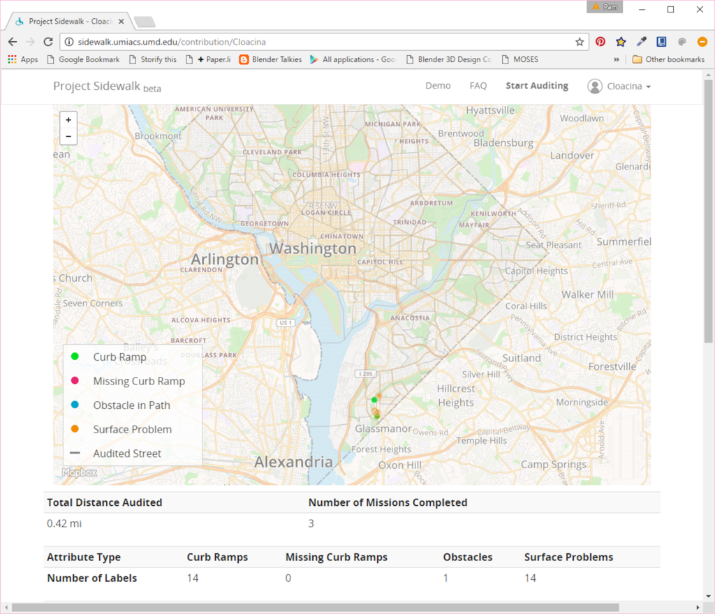
Finally, you can view your dashboard to see your overall contribution to the site. Below is my current status after only working on it for a short time:

Project Sidewalk Dashboard

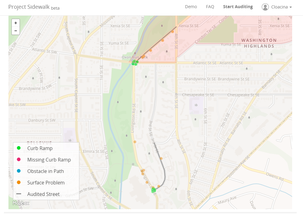
As you can see on my dashboard, the locations of the problems I found are displayed on a map. A zoomed in view of this is shown below. I was not sure if there was a way to see everyone's contributions, but if so, this would be very helpful to a city engineering or public works department in managing their sidewalk or street repair program. It would also be helpful if the data could be extracted from a given area so it could be overlaid in a city's GIS with other data such as land use, destinations such as schools and hospitals, and locations of capital improvements and developments.

Project Sidewalk Map Zoomed

Because the site is so easy to use, cities could also partner with schools and ask students to participate in inspections. This would help to engage students in their community and build awareness of the needs for and barriers to accessibility.

From what I can tell, the group also has the code for the site over on GitHub. Their license grants permission to make use of the software according the terms specified, and instructions for setting up your own development site are provided in a README file.

You can follow the group's progress through their Twitter feed: @umd_sidewalk.

Share

Preparing Yourself and Your Organization for the Future!

drone by fellowdesigns on morguefile.com

drone by fellowdesigns on morguefile.com

Staying competitive in this time of rapidly changing technology is starting to look more challenging every year. Driverless cars, rapid-fire communications, drones, laser scanning, virtual and augmented reality, 3D visualizations – all just a spattering of the onslaught of technological advances our field has seen implemented over the last few years. And if we are to believe Moore's Law, this rapid growth in technology is not stopping anytime soon. Instead it is increasing exponentially and will continue to do so until we get to the point where technology will advance along a vertical projection. Do you have a plan for this future? What are you doing for yourself or your business to prepare? What can you do?

I may not have many answers myself, but I recently heard a presentation from someone who might and thought I would share some of his insights. Meet David Zach, a person who has been officially trained in the future and holds a "master’s degree in Futures Research from the University of Houston." He was one of the keynote speakers at a one-day conference hosted last week by the Southeastern Wisconsin Chapter Association for Talent Development. He started out his talk by asking something I'd never before considered: "who is your role model on how you enter the future?"

For me this seems to be a very unusual question, and I'm very interested in hearing who people might choose so please share your ideas in the comments if you get a chance. For me, you might think I would have picked someone who is the very personification of future readiness. But instead I realized the person who motivates me most to learn, embrace,and implement technological change is someone I know who was close-minded and not at all prepared – ME! Well, me at about age 20 when a colleague interrupted me from hand-drafting a mylar plan sheet with ink and a Leroy set to show me a plan sheet drawn with the use of CAD. Did I say cool – can't wait!? No, I said, that looks horrible – that will never replace plans drawn by hand – there's no comparison. I think that was probably the least intelligent thing I have ever said in my life, and because I was obviously so wrong, the experience taught me a great lesson and motivated me to never be that close-minded again.

Leroy Lettering Set

But back to Zach's talk…the surprising overall message I got from it was the secret in being prepared for the future is not really found in technology or in the need to understand the specifics of it at all. Instead Zach stressed the importance of connections, learning, and the past. He said, "in a time of drastic change it is the learners who inherit the future." He explained how this is tied to how we research topics. If you need to know something do you Google it, go straight to the answer, take what you find, and go on your way? Or are you the type who researches the topic, reads the sidebars, goes off on tangents, then comes back to the main point before moving on? In the end, Zach said how we research topics becomes critical to our ability to encourage creative thinking and understanding. He said, "without diverse experiences you don't have enough dots to connect." So it is the person who collects as much information he can find that at first glance might not seem directly related who can later make those connections and fill in the gaps to come up with innovative solutions. He compared the process to building a web of information from which you can collect ideas and insight.

Connecting the dots graphic

Zach also gave us seven specific suggestions we should start doing right away. While some might initially seem bad for our health, I think he might instead be encouraging us to observe behaviors related to these activities and the environments in which these things occur and consider how they might encourage growth and innovation:

1. Start smoking 

2. Start drinking 

3. Protect and direct attention (play with fads, work with trends, and live by principles)

4. Change and tradition

5. Elegance and Eloquence

6. Concierge mindset

7. Play

The other advice Zach left with us was a list of what we should read/watch to help prepare us for the future. I've left what I could collect from the talk below. (The links are tied to an Amazon Affiliate account for the Public Works Group. So if you buy through a direct link from our blog, you help support the site and have our eternal gratitude!!) And if you ever get a chance to hear Zach speak, I'd definitely take advantage of that opportunity. He was funny, inspirational, insightful, motivational, thought-provoking, and a really nice guy.


Share

Do you have a permit for that Pokemon?

Pokemon Screen with PokeStops

Pokemon Screen with PokeStopsAbout five years ago I wrote a blog post about augmented reality and the concerns a city might have over its potential impacts to a community (see Adding Augmented Reality to Your Zoning Ordinance). But I had not noticed the types of issues discussed in that post actually occuring until this week after the release of the incredibly popular Pokemon Go game. If you have not yet heard about the game, it is an app you install on your phone which represents you on a map of your location and allows you to capture Pokemon who randomly spawn while you move through your environment. As with most games, you level up and collect objects as your Pokemon collection grows. There is also virtual infrastructure supporting the game such as PokeStops typically located at points of interest in a community. PokeStops gift you objects when you visit them and spin the stop on your phone. They can also be set up to attract Pokemon. Other fixed objects in the game are Pokemon Gyms where your Pokemon can battle other Pokemon.

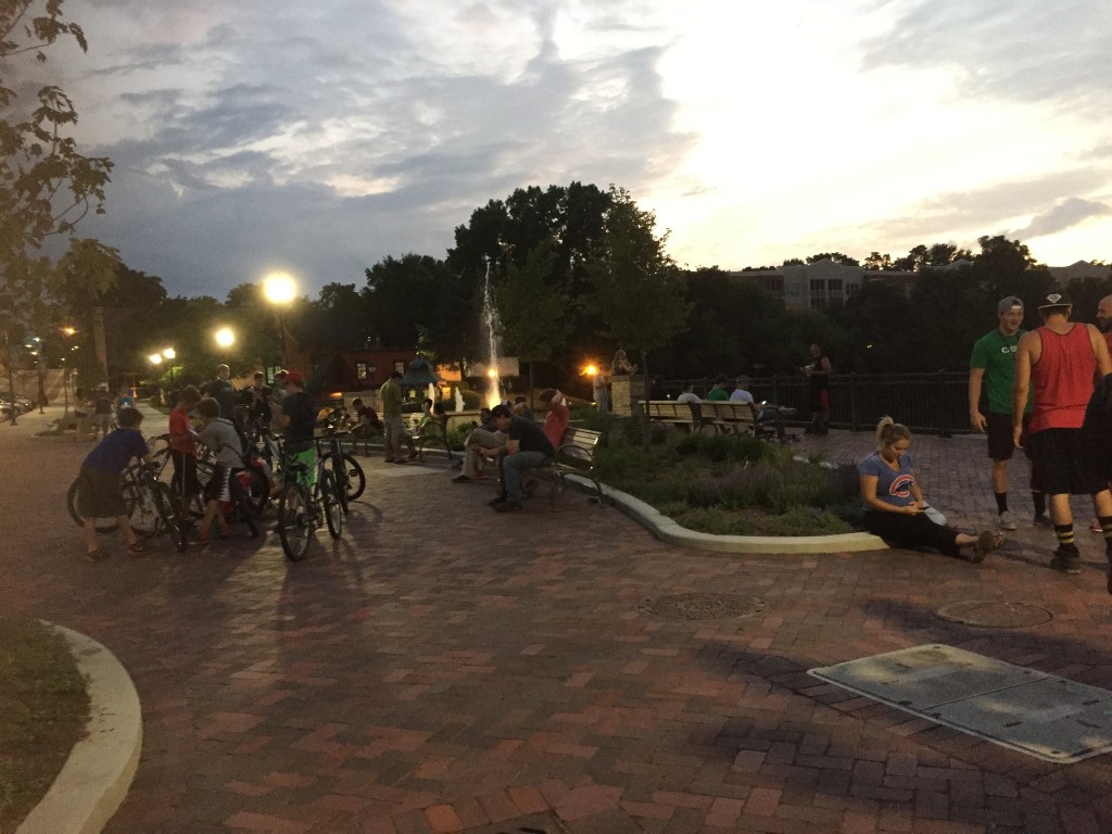
So what is the big deal and how does this relate to zoning? The issue people are having is not only the location of the random spawns of Pokemon, but also the placement of the fixed objects, particularly the gyms. The company which owns the game makes the final determination of where these all occur – they don't need to ask permission from a property owner or the city to place their virtual objects. So there have been reports of Pokemon showing up in places that appear to be on private property, and people are trespassing to catch those Pokemon. While this might be an occasional issue with a random person showing up, the more serious problem reported appears to be with the placement of the gyms. Both the gyms and the PokeStops have the potential to attract crowds of 30 or more people at a time.People playing Pokemon

To get an idea of the concerns gyms and the resulting crowds are causing, here's a Tweet from a person who lives in a home in a renovated church on which a gym has been placed.

If you read through @boonerang's Twitter feed, you will see questions raised about impacts to property value and hours of operation. At what point do the impacts become significant enough to warrant the need for government regulation? And if regulation is imposed, will it be through permits? zoning?Right now, it appears the company is the sole decision maker on whether or not that gym remains at this person's house. While they have offered a method by which someone can report an issue with a gym, the removal is totally at their discretion. Should the local government have the ability to require its removal?

The other topic I have not yet seen explored is the potential problems with the type of virtual content. Pokemon Go is a G-rated game with cute little characters and objects. What if someone launches a more adult game with much more adult content? Someone who might tolerate a cute little Pokemon might not feel comfortable with X-rated content appearing on their property, even if it is only virtual. Should adult use zoning ordinances also apply to virtual content to ensure it does not get placed within so many feet of a school or church? And if so, how would the city regulate this and address complaints? A city employee downloading and installing something like Pokemon Go to check on placement of objects might be tolerated, but would downloading and use of something much more adult be allowed even if only used for regulatory purposes?

The world is definitely changing. And now that augmented reality has actually shown up in the form of cute little creatures, it will be interesting to see if or how cities and other government entities address the use of their virtual spaces. The legal questions which might first need to be answered are do property owners have ownership of the virtual space within the geospatial coordinates of their property and does government have the authority to regulate virtual content within the geospatial coordinates of their boundaries?

(The photos in this post show a location where people hang out to catch Pokemon. The one photo is everyone playing and the other is a screenshot showing the gym and PokeStops at this location. The pink petals around the PokeStops indicate people have placed lures there to attract more Pokemon.) 

Share