Most of my exploration of virtual worlds for engineering has been in Second Life and OpenSim. However, this year I have been looking more at Unity3D. Engineers are conservative and seem to dismiss virtual worlds like Second Life and OpenSim. Even though these programs are 3D modeling tools, they don't resemble nor do they use the typical CAD tools engineers are used to working with. Because Unity3D works well with these CAD tools and better resembles modeling programs, I suspect it will find greater acceptance by AEC groups.
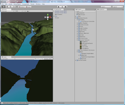
As an example of what can be done with Unity3D, I show below a crude example of importing DEM files into Unity3D. While the process is fairly easy, I still have some issues with the elevations looking too exaggerated, and there is an area that does not have contours. I also need to figure out how to apply the aerial images to the ground. So I still have a lot of work to do to refine this, but I thought it was pretty cool to be able to import contours and see the flat land transform immediately to reflect the topology of my city. I put some water in the model to indicate the river which helps to highlight the dam and islands. But I have yet to add any buildings, trees, or other features.
Fox River Valley in Geneva, Ill.

Another cool aspect of Unity3D is it can be embedded in a browser. Below is the static representation of what I created showing a view looking north through the river valley. Eventually I can add the capability for someone to travel through this model of my city with an avatar.
[WP_UnityObject src="http://www.publicworksgroup.com/images/stories/test1.unity3d" /]


