Microsoft Tags Go Live

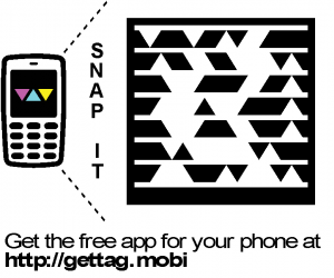
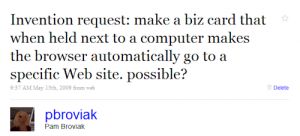
Back in May I was hoping someone would make a business card that could cause a computer device to go directly to a Website. @pbroviak Tweet May 2009While this technology might have been possible back then, it did not seem readily available to a regular person like me. But no more! Microsoft has come to the rescue creating a cool little tag that transmits information, including Website URLs, directly to a mobile device.

So how does this very awesome and incredibly cool Microsoft tag work? Well you merely have to register on their site, create a tag, tell it what you want it to convey, then render an image file. This file can then be placed anywhere it fits (or anywhere you can legally place it). I am going to put some on business cards, but I noticed that even an image of the tag on a computer screen triggers a mobile device into action. Here is the one I made to trigger a visit to my main Website. If you have a mobile device with a camera, go ahead and download the app at http://gettag.mobi/, then start up the app, and point your camera at the image below. Then shoot on over to the Microsoft Tag site to make your own! (And a huge thanks to Microsoft!!!)
MSTAG PWG Website

Share

Virtual Cemetery Update

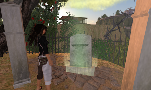
While exploring the virtual grid for government-related sites, I stumbled across a virtual graveyard on the Prince Edward County (Ontario) island in Second Life. And while Second Life has several interesting cemeteries this one caught my attention because the builders had loaded some of the stones with historic narratives from the Prince Edward County area. Thinking about my previous cemetery post, I decided to load a quick update on the topic. Here is a photo of me standing near one of these stones as I listen to the tale of shipwrecks and dangerous vortexes.

Pam Renoir at Prince Edward County Graveyard

The site was developed by the Virtual World Design Centre of Loyalist College. The Centre’s managing director, Kenny Hubble (Second Life name), was not online during my visit, or I would have asked him more about the build. If you are interested in using virtual technologies for teaching or tourism or even virtual cemeteries, I would highly recommend contacting Kenny in Second Life. Or if you want to just check out the cemetery for yourself, you can click this SLURL (you will need a free Second Life account to visit):
http://slurl.com/secondlife/Prince%20Edward%20County/179/161/33

Share

Social Networking Lessons for Building Local Communities

A city’s sustainability and stability relies on an active, engaged, and innovative population. But local government was never structured to address this social aspect of community even though many expect it to do so. Instead, as Tim O’Reilly said in this video, government is like a vending machine, “we pay our taxes and out come services.” So can governments succeed in building community by following lessons provided by successful social networks?

Here is an example of applying Social Networking Best Practices to Government. (The best practices are taken from the following Smashing Magazine post: Social Network Design: Examples and Best Practices):

1. Engage Quickly
Let people know what your city is all about, tell them what is going on in your city, promote interesting sites/information about local businesses or attractions, help them find others in the local area with similar interests.

2. Let Users Express Themselves
Provide outlets for local citizens and businesses to tell people about themselves and your city. Encourage creativity and self expression. This could be achieved through the use of print or digital media and hosted events.

3. Be Dynamic
Provide up-to-date, relevant, and interesting news and information about your city on a 24/7 basis through a variety of media formats. Encourage the entire community to contribute to this effort.

4. Allow Friends to be Grouped
Encourage the formation of committees and community groups. Many cities already have vibrant groups such as service organizations, religious institutions, scouting, etc. established within their area. Government can promote these existing groups, help others in the community find them, suggest ideas for other groups, and help provide training or assistance in the formation and management of groups.

5. Use OpenSocial
Ok, maybe this one doesn’t directly apply but let’s see how we can relate this to local government. The suggestion is to provide applications to users. So local governments can determine what types of “apps” could improve the community. Then provide the environment for local “developers” to create these applications. Perhaps it is coming up with a better way to pay bills or fees or secure permits or find parking or places to shop. Manor Labs is a good example of this concept in action.

The other idea presented in this section is to allow the creation of profiles. This is an interesting concept when applied to government; almost like creating some type of digital ID for each citizen linking them to your community. Then awesome people from your area become local ambassadors for your city.

6. Make it Easy to Communicate
Local government could work to provide channels of communication and encourage conversations. This can be achieved through sponsoring or hosting radio, print, television, and Web channels. Professionally moderated debates and discussions about local issues would also enhance conversation.

Partnering with local schools to encourage and teach younger citizens not only improves their communication skills but it enhances their sense belonging and provides a format for their contributions.

7. Show Only Relevant Information
This is important because too many times in government one person with an agenda hijacks the entire show. And usually no one else is interested in their agenda. Governments need to discourage one-sided rants or self-promotion and instead focus on creating a format that allows for everyone’s input and ideas.

8. Make it Easy to Take Action
Neglecting to provide a format where everyone can contribute really discourages buy-in and a sense of belonging. And those are two vital components to making the whole community thing work. Successful network managers make it a point to connect with their members and suggest ways to get involved that build on a member’s strengths. Local governments build successful communities by fostering this same sense of belonging and encouraging contributions.

9. Show Avatar Photos
The city of Chicago Millenium Park Fountain is a great example of how a city can apply this strategy. The fountain showcases photos of people. Others cities could take this same concept and apply it in a similar manner by displaying photos of citizens in some public medium.

10. Include Ways for Members to Connect
This step is related to the group and communication steps above. City directories provide somewhat of a framework for this but only group people by location. This could be expanded to include groups based on tags everyone uses to describe themselves.

And here are a few extra of my own:

11. Make it Fun to Belong
People are spending an increasing amount of time in MMORPGs and virtual worlds. Why is this? They are virtual communities that not only give participants a reason to belong, but more importantly they are fun and make everyone “playing” them feel better about themselves. And while life might not be a game, there is no reason we can’t enhance our lives so they are more fun and increase our sense of worth. When we are happy and feel good about ourselves, we are more productive and more likely to help others achieve these same feelings. So can government emulate this “gaming platform” and create something that encourages the same type of participation and distributes rewards to citizens. (Perhaps I need another post: Online Gaming Lessons for Building Better Government!)

12. Hire a Community Manager
All cities have people who are responsible for taking care of government assets like property and infrastructure. So if the social framework of a city is just as important as physical assets why don’t we have someone charged with taking care of it? I used to joke with people cities needed to hire a “city mom” but really what is needed is a community manager. Someone who manages or oversees the community in a manner similar to an online social network manager. And their job duties would follow the practices listed above.
Share

Virtual Cemeteries

Managing a public cemetery is just one of the many tasks handled by a public works department. Typically we take care of cutting grass, repairing monuments, paving/plowing roads, removing leaves, burying people, selling lots, and handling the documentation and requests for grave locations. Little has changed over the years in how these duties are administered. But now, new tools like mobile devices, virtual worlds, and augmented reality offer us the ability to enhance delivery of some of these services.

Augmented reality (AR), or overlaying a computer generated image onto the real environment, is now available with the use of a mobile device like the iPhone. So how can this be used in the cemetery?

First let’s see how the City of Manor, Texas, used AR to created a Christmas greeting with the help of Muzar.org: http://www.flickr.com/photos/cityofmanor/4203935446/

Applying this concept to cemeteries, cities could contract with organizations like muzar.org to allow people to post digital content for their loved ones grave site. This content could be images of the loved one or family or even the home in which they lived. As a genealogist, I could also see the benefit of displaying documents related to the person’s life. Perhaps eventually people would be offered the chance to save this digital information for their own family history files.

At some point perhaps AR could also allow us to input a loved ones name while standing in the cemetery and have a virtual path displayed on the ground leading us to the grave. This technology could also allow the city to arrange for unsold lots to display a certain color when a person scans the cemetery with a mobile device.

The city of Manor is also using QR codes – here is an example of their use in a city park: http://www.flickr.com/photos/cityofmanor/2780890639/. Cities could use these codes in the cemetery to convey information. The codes could be placed on or near the graves or on maps printed out from a city Website or distributed at the cemetery. Then visitors to the cemetery could access the code once they are in the cemetery. These codes could link to information posted by the family, to information held by the city about that gravesite, or even at some point to information about the person on sites like Ancestry.com.

Finally something I have not yet seen but wonder at its application is the use of virtual worlds. If a cemetery was recreated in a 3-D application such as Second Life, a person could virtually visit the cemetery. This technology also allows for people to attach information, images, and video. I also wonder if someday we will be able to link our avatar’s movements to our own. Then while standing in the real cemetery we could access the virtual cemetery on our mobile device and walk our avatar to the virtual grave while we walk to the real one. This would allow us to experience whatever was placed at the virtual grave while we are standing at the real grave.

As an add-on: @RogerSmolski passed along a link to an interesting post about the use of QR codes in cemeteries in Japan: QR Code from The Grave

Also I am trying to add at the end of each post a disclaimer indicating that the opinions expressed here are my own and are not meant in any way to reflect those of my employer.

Share

APWA Goes Social

Many established professional organizations and associations are still trying to figure out social media or worse, have not yet even heard about it. Which can be frustrating for members because social media provides a great way for members to network. And networking is one of the main reasons people join associations. However, members of APWA will find that their organization not only understands social media, but is well on its way to using it for membership engagement and interactions.

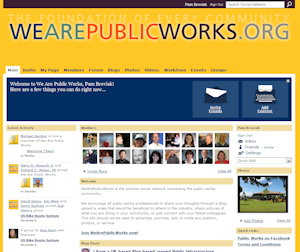
Earlier this year, APWA launched a Ning-based network: We Are Public WorksWe Are Public Works Screenshot This network offers not only members, but anyone interested in public works, a place to discuss common issues, share photos and videos, and announce events. Launched earlier this year, the site already has over 700 members.

In addition to the network, APWA has a Twitter account for the APWA Reporter. This account regularly Tweets information from the organization’s publication. The Arizona Chapter has also established an account at http://twitter.com/APWAArizona. Other Twitter accounts related to APWA are: APWASnow and APWACongress

For those of us on Facebook, APWA has set up a Facebook page.

Lean budgets have reduced networking and education opportunities for many of us working in public works. By taking advantage of APWA’s social networks, we can stay connected and find ready access to resources.

Share

Boots on the Ground: Building a GIS, Part 1

Introduction
I started building a GIS for my last employer in 1993. Because it was a part-time endeavor, we did not even get close to what I consider a full implementation by 2009. But I can say we at least had a GIS with some geo-referenced, verified data that could be used by all departments in the city.

Through it all I gained a good, first-hand knowledge of the challenges faced by each community undertaking this journey. So for some time I have wanted to share with you some down-to-earth insights and ideas. If you are an experienced GIS user, I would be very interested in hearing how your ideas or experience compares to mine and in having you share your insights. And if you are just beginning, I hope this helps to encourage you to begin and offers some basic guidance.

A Little GIS History
Drafting RoomEven though GIS has been around for decades in one form or another, there still seems to be a general misunderstanding and an awkward handling of this technology. In government and in particular in the engineering field GIS seemed to creep up onto unsuspecting drafting personnel. Just as they were getting used to making the transition from drawing with pen and paper to CAD, this new beast called GIS emerged.

CAD StationMoving to CAD had really only required the need to learn a new set of tools. And while this did have somewhat of a learning curve, at least the process and product was familiar. The information brought in by the survey crew remained the same: points, elevations, etc. The drawing format remained the same using the typical plan and profile format. Even maps were produced in the same style and format.

GIS on the other hand at first seemed to be from the realm of the planning department with initial uses focusing on zoning, corporate boundaries, land use, and parcel information. Perhaps this is why in many agencies GIS emerged from planning and has even remained under this department’s oversight.

So even though mapping seemed to always be grounded firmly in engineering, staff in some engineering departments did not initially embrace this new method of cranking out maps. A general lack of knowledge and awareness about GIS coupled with the need to learn yet another tool and the added challenge of changing an approach to how information is collected, presented, and maintained created too big of a leap.

However some engineering departments successfully made this transition because they realized early on the benefit of using this technology instead of CAD to represent utility information for water, sewer, electric, etc. And by now most engineering departments share this approach. But, the distinct difference in the drawing styles, delivery, and philosophy behind CAD and GIS remains, and this is where I believe the awkward handling of GIS in an organization begins.

This confusion and misunderstanding affects where GIS is located within an organization. While the engineering department has traditionally been the government office charged with map production, a quick survey of where GIS hangs its hat in each agency will reveal a variety of locations including engineering, planning, community development, IT, emergency response, police, fire, and even in a department completely on its own.

Another aspect of all this is the wide variety of GIS implementation between agencies across the U.S. Some are GIS rich with a wide range of data all geo-referenced, verified, and available to the public while others are GIS poor with little to even no GIS data available, collected, or offered. And there are many that would fit anywhere in between these two extremes.

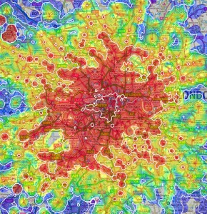
Multimodal Map of LondonWhy is this important to all of us? The awkward organization of GIS within an agency and the wide disparity of implementation? Because the world is fast moving beyond CAD and GIS into the next phase of information management. Those who haven’t figured GIS out or even worse, those who haven’t even begun are going to fall further behind. This difference in knowledge handling can be compared to one community having all dirt roads and another having interstate highways. And just as road conditions can affect growth and economic development so can the state of a community’s knowledge base.

Look for the next in this series: Starting to Build a Local Government GIS

Share