A Critical Lesson from the Gaming World

World of Warcraft ScreenshotThe momentum for using games in a workplace environment seems to be building. The topic is showing up in conference programs, blogs, forums, and now in a TEDTalk. People are realizing what the game industry figured out long ago – it’s possible to create something that consistently encourages and trains people to perform specific tasks for hours upon hours. And they are asking, how can we transfer this to the work environment? Others, like Jane McGonigal in her TEDTalk, are asking, how can we leverage this to make our world a better place? (You can watch her video embedded at the bottom of this post.)

A Teenager’s View
This is a particularly interesting topic for me because of a few reasons. First, everyone in my family is a heavy to moderate gamer, and second, I see many ways gaming could be used to train and educate government staff, elected officials, and citizens and enhance workplace performance. So we watched Ms. McGonigal’s TedTalk as a family (I know – a total geekfest). Afterwards we discussed her comments. I was particularly interested in my 16-year-old son’s thoughts. He fits the demographic of which she spoke.

His belief was that a game designed to educate or “do good” would not be as attractive as “regular games.” He thought no one would play a game that made the education or public service component too obvious. My husband and I agreed that for it to work well, the game would have to do a good job balancing game elements found in popular games with the underlying purpose. He did echo McGonigal’s comment that he didn’t feel he could do much to change the real world, and that is why he thought most people would not play a game to purposely make the world a better place.

The Critical Lesson
But from our discussion also came one more significant reason we feel people play games. And it’s a reason I have not yet heard mentioned. We feel it is because the game is impartial in its distribution of rewards. And this we feel is a vital if unrecognized component.

Many of us have at least one experience in life where we gave it our all, tried very hard, and accomplished something outstanding that everyone agreed met the requirements for a specific reward – maybe it was an “A” on a paper, or a school award, or a placement on a board or committee. But we never got that reward. And why is that? Usually it was because a teacher didn’t like us, or we weren’t the most popular person in the group, or we didn’t fit into the right crowd. Whatever it is, we have learned that rewards in the real world are not impartially or fairly handed out.

But the computer is always impartial and fair – if an Orc in Orgrimmar gives you a quest with the promise of earning a new shiny sword, he gives you that sword when you complete the assignment. He doesn’t decide not to give it to you cause he heard you hang out with Night Elves or you don’t belong to the right guild.

So perhaps this is another critical lesson from the gaming world, you can motivate people to invest time and money and effort if you are fair and impartial in the distribution of the promised rewards.
Share

Augmented Reality for Public Works

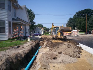
Construction siteAugmented reality (AR) has been gaining ground over the last couple years—most likely as a result of an increasing number of applications incorporating AR and an increase in the capabilities of supporting technology. But while the advances have been useful and impressive, I have not seen much related to the public works industry. This surprises me because AR could be incredibly useful and could increase efficiencies and decrease costs. So I thought I would post a few ideas of ways in which AR could be applied to the public works field with the hope that someone takes up the challenge and implements these tools:

Utility Locates:
Utility locating can be a pain, but it is important to prevent damage to the utility or injury to people working near the utility. Current tools of the locating trade can include a map on a laptop or on paper, locating devices for accurately pinpointing the utility location, shovels, picks, probes, and paint or flags for marking the location in the field. The reason this task is so challenging is the need to rely on maps that many times are not accurate enough to allow the locator to just walk right up to the utility.

For example, a locator might have trouble finding a water shut off valve in someone’s yard if it is buried under snow or dirt. If there are accurate measurements to the valve, the locator uses a measuring tape and map to find the general location of the valve. And if there are not accurate measurements, which is often the case, the locator would have to randomly search the area with the locating device. Once a probable position is determined, the locator digs for the valve with a shovel. This can result in multiple holes being dug before the valve is found. If other utilities are in the area, readings can be inaccurate which makes finding the valve even harder. The whole process can be very time consuming.

Some cities have their valves in a GIS allowing the locator to walk to the approximate location with the help of a GPS device. This is very useful, but how much better and more intuitive would it be if the valve could be projected digitally onto the ground using augmented reality. The locator drives up to the site, gets out of the vehicle and puts on a headset or uses a mobile device, and all the utilities show up on the ground through the use of augmented reality.

Engineering Design:
Using this same idea, engineering design could be greatly simplified. If an engineer needs to improve a road by installing curb and gutter and a new storm sewer, maps must be collected and utilities marked in the field to designate locations of gas, electric, water, etc. Only then can the engineer determine the best place to put the curb and sewer. If all an engineer had to do was drive out to the job and use augmented reality, the best locations for the new improvements could be determined faster with more accuracy.

Engineers could also use this if a resident calls with a problem. Many times, when we respond to residents, we do not know exactly what the problem really is until we get to the site. So we might not have everything we need to determine if we can help with the problem. But if the resident had a question or problem related to a utility such as needing to tap onto our sewer or water or if they had a drainage problem and needed to tap into our storm sewer, I could not only determine right away if there was a feasible solution, but I could also show the resident by having them use the technology. Seeing the line on the ground would mean more to them than looking at a line on a map. And how much better it would be for them if we could animate the line somehow showing water flowing.

Maintenance and Construction:
Augmented reality could also be used to make sure crews are working on the right asset in the field. If we could digitally mark the manhole that needs to be fixed or the tree needing to be pruned, or the area in which I want landscaping planted, we could reduce confusion or errors in the field.

And if a contractor is installing a pipe, he could use augmented reality to see where he needs to dig. This could also assist the city in showing property owners where improvements will be made. Residents could use AR technology and actually see how the new road will look.

I could have also used AR when I was putting up the trim at my last house. This would have prevented me from drilling into a pipe or it could have helped me find the studs.

There are a lot of other uses we could figure out to help us better perform our job in public works. Hopefully this post helps generate some more ideas and maybe even challenge someone to develop an AR for public works tool.

Share

A Brave New Grid – The Decision

Last month I decided to close down the Public Works Group island in Second Life. Over the last 2 1/2 years, the island allowed many people the opportunity to see and explore how virtual worlds could enhance the public works industry. The site also provided a place for people to meet and experience virtual worlds in a relatively safe place – the only exception being the occasional disruption from people intent on causing problems in Second Life.

Summary of accomplishments
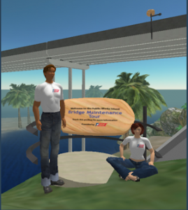
TEEX Bridge TourOne of the first projects launched on the island was the Bridge Maintenance Tour built by James Matney, project manager for TEEX. This build was a great example of how someone could simply set up an educational resource in virtual worlds.
(Link to video of the bridge tour: http://www.publicworksgroup.com/videos/bridgetour1.wmv)

Another prototype of an educational resource was the Code House, a virtual single-family residence allowing for the 3-D visualization of the building code. Since the house was built, there have been at least two other examples of this educational concept constructed in Second Life. One by the Planning Portal in the UK and one by the FAS.

Public Works island also hosted the founding of MuniGov – an online community of local government professionals established by Bill Greeves and myself. Meetings for MuniGov were held on the island from about Sept 2008 until the closing of the island. Last year in April, Public Works hosted the trade show and after conference activities for MuniGovCon09 – the first virtual conference for government.

So What is the Deal?
Those are just a few examples of the many accomplishments and activities supported by Public Works island. So, you might be wondering, if the island was providing benefit why close it down. One of the key reasons is cost. Because public works is a primary function of local government, this field along with government in general must pay close attention to costs. For a virtual world tool to be embraced and used by local government, the cost must be acceptable not only to those managing government but more importantly to taxpayers.

Another reason is accessibility and perception. While firewalls can easily be configured to allow access to a virtual world, some IT government professionals are hesitant to create these openings due to security concerns. This is not helped by the fact that mainstream media has portrayed Second Life as just a crazy game with people running wild leading those not familiar with the technology to disregard it as a serious business tool.

Last year, members of the Emerging Leaders Group for APWA researched the use of Second Life as a viable tool. While they saw many benefits of the technology, they shared in the concerns expressed above. (Here is a link to the group’s report, Communicating with APWA Membership, New Media Evaluation.)

While I was aware of these issues when setting up Public Works island, I did think that eventually Linden Lab, the creators of Second Life, would see the value in offering solutions to local government and would end up addressing cost, perception, and accessibility issues. However, based on their actions and decision over the last 2 1/2 years, I am no longer convinced they will move in this direction.

Onward Ho!
While I still see value in exploring and using Second Life, I realize that local government needs a different solution – one that costs much less and that can be better controlled. Fortunately there is such a solution. Opensim software has now been developed to a point where local government can launch a stable and cost effective virtual world using this alternative. The other benefit of OpenSim is the use model of this choice parallels the existing Web hosting model already implemented by many local governments.

So the Public Works Group virtual world initiative has moved on to create GovGrid – a government-focused virtual world. This initial world or grid now consists of four islands that initially will host the following uses:

  • Orientation/Tutorials/Help Resources
  • Sandbox where members can learn to build virtual objects
  • MuniGov outpost
  • Research and Development
  • Other government agencies, groups, and vendors working with government can set up space in this grid knowing that there will be a government focused community. The OpenSim solution also allows for control features designed to meet security and backup concerns.

    So What’s Next?
    If local government is going to use this technology there needs to be some type of guidance provided to help agencies understand and set up their own virtual space. I thought by sharing my efforts in establishing GovGrid, I might be able to help others who make the decision to move down this path. So instead of setting up everything and then inviting people in, I am inviting everyone to watch as I begin establishing the grid and creating the content. I will also continue to blog about the progress of GovGrid through future posts.

    You can register at the GovGrid Web site at http://www.govgrid.org which should then allow you to access the registration for creating an avatar on GovGrid. Then follow the instructions for accessing the new grid. Remember things are still under construction, but feel free to wander around, check things out, and ask questions. And if you work for government or for a company or group that does business with government, you are invited to eventually become part of GovGrid by setting up your own virtual space on the Grid.

    See you in GovGrid!

    Share

    Measuring Success of Virtual Spaces

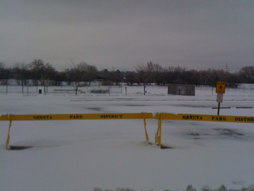
    Baseball Park in WinterIn order to reach a valid conclusion about the success of a virtual space, we need to understand the reason that space was created. If someone knew nothing about baseball and visited the large barren, snow-covered baseball complex near me that no one has entered for the last 7 months because it has barricades across the drive, they would say what a waste of space. Why would anyone spend millions of dollars to create that? But isn’t this the same conclusion people are making when they decide sites in Second Life and other virtual worlds have failed because they don’t see people there 24/7?

    Instead of analyzing success based on the site’s ability to perform its function, they are basing success on the same method used to analyze Web site performance – by site visits and page views. But this is not the correct method by which to measure success of a virtual world.

    It is important to understand that virtual spaces are not just static Web pages; instead, just like the baseball park, they are spaces built to perform some function. We have a local government group, MuniGov, that meets on a regular basis in the virtual world of Second Life.MuniGov Meeting If you visited our site, there would most likely be a group of people there only during our meeting times. The site also serves as an area of exploration in the use of this technology. Has the site been successful? A quick random visit will not give you this information. Instead you would have to attend a meeting and talk to members. By doing so you would find that our site has allowed many people to learn and better understand this technology. It has also allowed us to share ideas and practices for improving our job performance. And several of our members have been awarded grants to pursue research and learning of government-related issues using this technology. These efforts enhance and improve delivery of real government services. Could this be considered a successful use of the space? Yes, and this is only one example from our group’s use of virtual worlds.

    The other challenge in establishing a true measurement of success in virtual worlds is developing a good general view of 3D communities. And to achieve this understanding, people must adjust their perception of spaces. This is not easy because it takes more than one visit into a virtual world to allow this to happen. I was reminded of this recently when I talked to someone who had only visited Second Life for a few hours. This beginning experience is not intuitive or comfortable. It’s easy for people to decide they don’t like this feeling and then never return. But most worthwhile, life-changing efforts begin the same way. And we only reap the benefits if we have motivation to push past the discomfort. In the end, only people who have made the transition and become familiar with these spaces can really understand what is happening there.

    The bottom line is being able to analyze the success of a virtual space is more complex than showing up, seeing no one around, and deciding the site is a failure. The longer I spend time in virtual spaces, the more analogies I see to our offline world. Which makes sense; both are built and used by the same people. But because of this, we need to quit relying on articles and blog posts to analyze our 3D worlds. Instead, we should follow our offline examples and develop comprehensive virtual plans and studies modeled after the same process of analysis we have for community plans. It’s how we’ve been measuring for years the importance and vibrancy of places where we live and hang out so why aren’t we using this approach for 3D places?

    Share

    CityCamp – Talkin’ Government & Gettin’ Scrappy

    Last weekend I was fortunate to be able to spend the entire weekend at the UIC campus in Chicago hanging out with about 100 other people who are interested in local government. The event was CityCamp – a conference held in unconference style where the attendees determine and host the sessions.

    While there were several GIS professionals there, I found no other attendees working in public works or civil engineering. In a way, I was not surprised – we are used to working behind the scenes and trying to remain below the radar. Our collective tendency to lie low is because about 98% of the time no one even realizes we are there – everything is running as it should and no one really notices or cares why. However, it is that small percentage of the time when things break down and cause a disruption in services that we are thrust in front of the cameras or the reporter’s pen and taken to task as if we have been doing nothing or purposely neglected our duties. And even though we try to explain our job and what caused the disruption, the resulting public article often leaves many of us end up feeling unfairly beaten up by the press.

    But if we choose not to get involved in this new social media stuff due to past issues with public relations, it doesn’t mean we will be ignored. And yes, public works was brought into the discussion at citycamp. So we can stay out of the online channels, but it won’t mean people aren’t talking about us and what we do. As an example of this, I embedded a portion of an interview between Tim O’Reilly and Chris Vein, CIO of San Francisco. From about 7 minutes in to about 9 minutes, public works is the topic of discussion. At some point, we need to ask ourselves, “can we really afford to stay out of the conversation?”

    Share

    Smart Tagging Engineering Plans

    The city of Manor, Texas, has been successfully using QR codes for some time to convey information to citizens. And a while ago, I blogged about Microsoft tags – another method of conveying information through the use of a code and mobile reader. The Microsoft Tags have intrigued me because if you have time, you can create a code that can be “hidden” in your logo or another image.

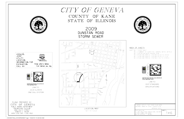
    Unfortunately I was so excited about trying out the tags that I didn’t take the time to make a custom one. So I can’t demo how cool that would be, but I can show you an engineering-based use for these smart tags. Below is the cover sheet of the most recent set of engineering plans I prepared for a small sewer job we are constructing in my city. On the cover we placed two codes. One is displayed near the JULIE or 811 One-Call logo – by running the reader on your mobile and focusing it on this tag, your mobile is activated to call for a utility locate. Before actually calling, the number is displayed, and you are asked if you want to call.

    Dunstan Storm Sewer Cover Sheet

    If someone runs the reader on their mobile and focuses on the other tag, the mobile device is routed to the IDOT Website page displaying the State of Illinois Standard Specifications for Road and Bridge Construction. These are just two easy demonstrations of how these codes can be used in engineering and construction. I am sure with time, more ideas will arise. Feel free to comment below with your own ideas.

    Share