Geneva’s Great Land Adventure

Geneva Land AdventureSeveral months ago, I read some blog posts about frustration with Gov 2.0 not doing enough and a few other posts with offers from people interested in working for free for experience. The two seemingly unrelated topics got me wondering: How could our city use Gov 2.0 to offer job opportunities to people just looking for experience and also offer opportunities to citizens interested in participating in government? My thoughts drifted to the projects I’m working on at my job. And I wondered if our city could reach out to these people with the use of Gov 2.0 tools to help us complete some of our projects. One particular project rose above the others as a perfect candidate – the creation of a database documenting all properties in which the city holds some interest. It seemed possible because all the research could be done online by anyone with a connection to the Internet.

Fortunately, my supervisor and city administrator were fully supportive of implementing this idea. And even better, an intern working for us who is a public administration graduate student was able to partner with us to set it all up. While we were planning the project, I noticed a post on GovLoop written by Dave Briggs: The need for micro-participation. It seemed to discuss exactly what we were hoping to do. His post and support of the idea of micro-volunteering inspired me to finish setting up the project. After it was complete, we took some time evaluating it. After getting some great input from everyone, the project became an adventure of discovery with a Viking theme complete with a Viking figure donated by our wastewater division staff. Now anyone can join us on a discovery of property. And people can even earn titles and rewards as they successfully complete documentation of areas. You can check out the site here: The Geneva Land Adventure.

While we realize this approach has been used before to crowdsource genealogy databases, we’re not sure if other local governments have offered similar opportunities for micro-participation. We would be interested in hearing from others who might be aware of similar examples of participation or information about property management systems already in place. And we would love to hear comments or suggestions for improving the project and would love it even more if you signed up and participated in our adventure! (And because property management in local government is not a widely discussed or known topic, I offer a little background below.)


A INTRODUCTION TO PROPERTY MANAGEMENT FOR LOCAL GOVERNMENT

People are usually surprised to discover that local governments have a significant number of interests in real estate or property. These property rights can be held in the form of deeds, dedications, easements, rights of way, or licenses. And, depending on a government agency’s size, the number of documents conveying these rights can range from hundreds to thousands.

What also surprises people is that agencies most likely do not have a property database in place to document and manage the property rights associated with these documents. When I started working at the city of LaSalle in 1993, I figured they didn’t have this in place because they were somewhat of a small community with a population of about 9700. So I got to work building the database and putting a management system in place. By the time I left in 2009, I had discovered about 300+ properties in which the city had some ownership right. What I’ve since realized from talking to others in government is that many cities lack a property database.

Based on my experience in LaSalle, I have developed a process of building the database and putting in place a management system. One of the first steps is to discover all the documents in which an agency has property rights. But this task can take significant time. Since starting a new job with the city of Geneva two years ago, I’ve been working on setting up the system here. Fortunately we already have most of the property held by deeds in a database created by the county tax assessor. But this information needs to be verified and all the other documents covering easements, licenses, dedications, etc. need to be discovered.

Some might wonder if it’s so much work, why bother. Well, in government, ownership and property rights come up frequently throughout the day. Most activities that go on in local government, particularly in public works or property maintenance, involve the need to know what can be done where. If a database does not exist, research must be done each time a question about rights or ownership comes up. With a completed database and GIS, the answers are much more readily available. There are other benefits, but to keep it brief, the bottom line is having the database saves time and money which is always a good thing to achieve in government.


Share

Adding Augmented Reality to Your Zoning Ordinance

Augmented reality holds promise and opportunity for the public works industry. With the development of this technology through efforts like the Smart Vidente Project and the recent release of development tools by Layar, we are moving closer to actual implementation on the job. And over the next few months, I plan to try to set up some layers for work using the Layar service. So I was discussing this with another engineer at work and trying to come up with some ideas to try out. We  thought about setting up some virtual notifications programmed to pop up when we approach certain properties in the city. These notifications could alert us to drainage issues, special structures in the area, and other information in which we would be interested. But as we imagined this future of virtual objects left waiting to be discovered, the other engineer came up with a brilliant question. He wondered if anyone could set out virtual objects like this, what would prevent the world from becoming a virtual junkyard.

DragonHe had an excellent point. Right now the technology is so new, we don’t yet have this problem. If I walk through out city today with the Layar app on my smart phone, there is a good chance I will see no virtual objects. But once the technology becomes ubiquitous, we could walk through our cities looking for something with our augmented reality app and find ourselves bombarded by virtual junk. This virtual junk would also detract from augmented reality uses for wayfinding and utility location. And what could be worse is that people could leave virtual junk on our private property. Maybe someone gets upset with someone else and decides to leave a virtual sign with some not-so-nice wording on that person’s lawn. So there will probably come a day when there will need to be some regulation defining where virtual objects can be placed. But once you start considering this and how it fits into our current system of governance and regulations, it becomes quite an intriguing discussion. Local government regulates and permits placement of objects in the right of way, so should this permitting be extended to virtual objects placed in the right of way? And who should have the authority to regulate what is placed on private property?

Developing the framework for regulating augmented reality in public and private spaces will take some thoughtful consideration and time. But setting this up now will make it that much easier when we get the first call from one of our citizens complaining because someone put a virtual, 20-foot pink dragon breathing fire on their property.

Share

Virtual Worlds: The Next Level of Government

Crowd by davidChief on FlickrIn small numbers, people can usually self-govern themselves. But as the number of people in a group grows, better control is needed. So history has shown anytime a large number of people start hanging out in a particular place, a government structure is formed. In our world today, we have nations which then have further divisions of government down to local or neighborhood levels. And while most of these levels of government are considered public, a small number are privately held and yet still considered a governing body by upper levels of government. So applying this to virtual worlds, have these digital places evolved to the point that another type of government level needs to be formed?

I would expect many people, particularly those who have not yet ventured into a virtual space, would scoff at the idea of creating a new type of government subdivision for computer-generated worlds. During my first few years of hanging out in places like Second Life, I had not considered the need for governance. But during those years, I observed many parallels between the growth of Second Life and the development of a city. And recently, the discussions surrounding the struggles of Linden Lab to address the needs of Second Life "residents," have me more closely analyzing the governance idea.

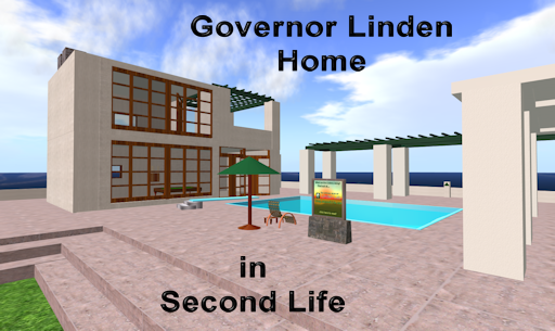
Although I don't think Linden Lab started Second Life with the intention of creating another governmental entity, it is interesting to see elements of local governance in the early days of the grid. Philip, the creator of Second Life, was labeled Governor Linden, and the users were called residents. Experiments in zoning took place on at least one of the first sims. And the subdivision and sale of land and payment of tier (tax) for that land is an emulation of land ownership in the U.S.

Second Life has gone through phases regarding these issues: tier is still paid and users are still residents, zoning has been created on a much larger scale with the division of adult, mature, and PG spaces, Philip is no longer referred to as Governor although public land is still held by Governor Linden. And as the Lab struggled to determine their policies in these areas, similarities between the problems faced by Linden Lab and those we face as city officials grew. Today there are demands by residents for better functioning infrastructure and platforms through which to voice opinions. Businesses are continually pushing for economic tools, incentives, regulations, and opportunities. All issues faced every day by those of us working in local government.

Server Farm photo from Sugree Phatanapherom on FlickrPost-Victorian water mains by Lars Plougmann on FlickrAt this point, Second Life has evolved to where the primary differences I see between its digital space and the physical space are in the type of infrastructure and the international population. And even the infrastructure, while different, still has many similarities to the operation and maintenance of infrastructure in the physical world because it is part of that physical world. Cities have water mains and roads; Second Life has computers and code.

So, the most challenging difference I can see is the International aspect of the Second Life population; governments in the physical world are based on geographic boundaries. Cyberspace has no geographic location in the physical world. Anyone with a computer and an Internet connection can access places like Second Life. So if a digital space became a governmental entity, into which governmental structure would it fit and in which country? And whose laws govern each person's behavior in that world?

If I travel to another country, I follow that country's rules and yet I am still bound by some of the laws in my own country. If I visit a digital space, I follow the terms of use for that world no matter where it is based in the world. Yet, because I am in the U.S., the U.S. government could argue I need to also follow laws of this country because I am using federally regulated bandwidth to access that world. So some might question, if there are already terms of use for visiting virtual worlds, why aren't those rules good enough?

Terms of use seem to work well for regulating behavior in digital spaces when user freedoms and choices are limited. For example I don't see Blizzard dealing with the same issues facing Linden Lab. Both companies have created virtual worlds, but the MMORPG offers a more structured space with well-defined and limited abilities for its users. While in Second Life, the users have many more freedoms and choices. I compare the MMORPG to a museum I would visit in a city like Chicago. My museum visit is structured and defined by the rules and environment created by that museum. While my behavior and actions in Chicago are only bound by the laws of the city, state, and U.S. government.

City Hall by Editor B - Bart Everson - on Flickr

Even with the growing similarities between digital and physical places, governance in virtual worlds is probably not on the immediate horizon. People are still just getting used to the idea of a digital world. But this concept of a virtual world functioning as an actual place could help companies like Linden Lab better understand what they have created. And as the Lab is finding out, running local government is not easy. But it is an age-old practice with thousands of years of models and literature available for guidance. Maybe what Linden Lab needs now to sort out all their issues is someone with a background in public administration.

Share

A Brave New Grid – Post 2: The Virtual Plan

Ontario Build in Second LifeIn the first post of this series, I explained my decision about moving my efforts related to building government/public works/engineering sites in virtual worlds from Second Life to OpenSim. And I invited anyone interested to read along or visit as I make this move. From here on out, I will continue to write about the thoughts and processes an agency follows to create and operate a virtual site:

Just like any good story, this one starts at the beginning—back before an agency even sets a digital foot into the virtual arena. Today many agencies might not have even heard of virtual worlds while a few others have heard of them but not yet thought about leveraging this tool to deliver value to citizens. But, eventually someone, either staff or citizens, will bring up the possibility of using virtual worlds to enhance service delivery. At that point the agency must decide whether to ignore the suggestion or investigate virtual solutions. If the agency decides to go forward, the first step is to create a virtual plan. Here are some ideas about how an agency would go about developing their plan:


Developing a Virtual Plan

Create a Project Team

Assuming an agency decides to venture forth, my first suggestion is to form a project team. Team members should be comfortable using online technology, possess good assessment skills and articulation, and have a comprehensive understanding of the agency’s general structure, goals, mission, and strategy. It would also be helpful to include a few community stakeholders on the team such as members of the agency's leadership, residents, business owners, and leaders in community organizations.

Set Goals and Strategies

The team’s first order of business is to determine what the agency would want to accomplish with the use of virtual worlds. These goals should align with the overall goals and strategies for the organization. This is also a good time to think about the targeted audience—who will visit this virtual space? Below are some suggestions for both virtual spaces and related audiences:

  • Engage local citizens.
  • Attract potential tourists and deliver visitor information.
  • Recruit potential employees, citizens, businesses.
  • Plan proposed development and receive input from citizens and developers.
  • Present 3D representations of code and ordinance requirements so residents/business owners can more easily understand and access regulations.
  • Train employees.


Decide on Software and Hosting

In order to develop, access, and maintain these virtual spaces, the agency will need to acquire a software package and possibly a hosting plan. Although virtual worlds may seem like a brand new tool, they function in a manner similar to a traditional Website. By this I mean that the agency will use development software to create the world and the content within. Then others will use a software program to access the agency’s site. And just like a Website, the digital space will require a computer on which to reside. Therefore, the agency will need to determine if their virtual space will be served out from their own computers or through a host.

Here is a list of the more common solutions currently in use for enterprise and government purposes:

Virtual world development can be complex so it’s critical the team identify features and requirements for each software package from cost to performance to ease of use and support. This is where tables and charts come in handy. Here are some suggestions to consider including in the analysis:

Developer    Purchase and Annual Cost    User base    Technical Requirements    Security     Scalability    Backup Capabilities    

Database Requirements and Compatibility     Storage Requirements

The team can assess each program by assigning a ranking for each feature and requirement. For example, if a low number is chosen to indicate a more beneficial choice, then the purchase price could be categorized by the following numbering system:

1 – $0 to $999

2 – $1,000 to $4,999

3 – $5,000 to $9,999

4 – $10,000 and greater


Technical requirements could be simplified into the following categories for ranking:

1 – Basic computer system costing less than $1,000

2 – Average computer system costing between $1,000 and $2,000

3 – Moderate computer system costing between $2,000 and $3,000

4 – Loaded computer system costing more than $3,000


Categories and rankings should be chosen to best describe each agency’s assessment of needs and capabilities. After assigning a rank to each category and adding up all the points for each feature and requirement, the team can rank the software packages.


Visit Virtual Worlds

Next the team should download the virtual tools and spend time in virtual worlds created by each software solution under consideration. It’s helpful to document observations and first impressions because this can offer insight into how the agency’s user base will experience their first visit. Team members might also visit existing government sites in virtual worlds. Usually people managing these sites are more than willing to share their experiences with others.


Establish a Virtual Site Policy

Visiting virtual spaces can also help the team formulate a virtual space policy for staff and visitors. For employees this policy can address their appearance, communication procedures and guidance, hours of work, and other issues related to representing the agency in a virtual space. For visitors the policy will cover how they should conduct themselves, what they will be allowed to do in the space, how they can dress, if they can access all or just a portion of the space, and consequences for not following the rules.


Develop Virtual Site Designs

After spending time in each world and interviewing managers of existing sites, the team can begin formulating a more specific idea of what they will want to create for their own agency. A framework for each can be designed to meet the agency’s goals and to fit within the constraints and structure of each software package under consideration.

Based on the type of build desired and the goals the agency wants to achieve, the team will develop alternative designs for the site. At this point, designs do not have to be detailed. Simply showing a square labeled “Central Business District” can indicate a design that includes a 3D representation of the agency’s downtown. The most important step is to make sure the designs include elements that allow the agency to achieve their stated goals.
Greenies from Second Life

Choose the Development Team

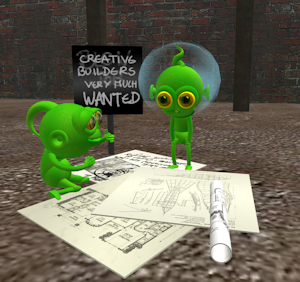
The team must next consider whether the agency can build the virtual site with in-house staff or if a consultant must be hired to perform the work. If the work can be down by agency employees, the team should identify members of a potential development group and their corresponding skills. In making this decision, the team needs to keep in mind not only staff abilities, but the availability of content for each virtual solution. Some worlds, like Second Life, offer extensive ready-made content and building tools that allow most people the ability to create an acceptable space. However, other software solutions require more extensive software skills and offer little to no content.

If a consultant will be hired, the team might want to research potential companies experienced in the creation of virtual worlds. It is important to identify which software tool each company has experience with and visit sites they have created. Interviewing past clients can offer insight into whether the company has the desired experience and understanding to handle a government agency’s requests and needs. Also check to see if the company has retained the employees who created past builds or if you will be working with a new and less experienced staff. Another important consideration is to check with past clients to make sure the company met deadlines and came within budget.

Establish Operations and Management Procedure

Once the site is established, there will be management needs. So the plan should include a section addressing how the site will be staffed and managed during the first few months and then for the long term. Decisions to be made in this step could include if the agency is going to staff the site with existing full or part-time employees or if new employees will be hired. Virtual sites are open 24/7 so the agency also needs to decide on what hours staff will be available at the site. If the agency intends to host events, the hours and staffing for these along with a proposed list of events should be included.London Re-creation in Second Life

Agencies also prefer to assess operations on a regular basis. If the site is created, this assessment needs to become part of the overall operation and management plan of the agency. With this process in place, the project team can be utilized on a regular basis to review the site on an annually and submit a report indicating how well the site is meeting the goals and objectives laid out in the plan. This procedure can also allow for amendments and changes to be made through an established process.


Compile the Plan

At this point, the team can begin compiling the virtual plan. The plan should include the following elements:


  • General proposal and description of what a virtual site is intended to accomplish


  • Specific goals, objectives, and strategies and how they fit into the overall agency plan including references to targeted audience/user base


  • Listing and discussion of available software solutions with a summary of the team’s findings (a more detailed report can be included in an appendix)


  • Proposed virtual site policy


  • Concept designs


  • Suggested development team


  • Timetable for execution of the virtual plan


  • Marketing and/or advertising plan including intended channels to be used


  • Short term and long term management of the site including staffing proposal


  • Assessment procedure


  • Budget for software purchase, development, and management


Once a draft of the plan is complete, it is advisable for the agency to host a few public meetings to get input from residents, businesses, and other community stakeholders. Comments should be discussed, and if appropriate, incorporated into the plan. Minutes and comments from all public hearings should be added to the plan as an appendix. The agency's attorney also needs to review the plan at this point and offer any needed revisions.

When the report has been finalized, the team can present the plan to the agency's board or council for formal approval.


Related reading and resources:

"Virtual Spaces: Enabling Immersive Collaborative Enterprise, Part 1: Introduction to the opportunities and technologies" IBM article

Share

A Critical Lesson from the Gaming World

World of Warcraft ScreenshotThe momentum for using games in a workplace environment seems to be building. The topic is showing up in conference programs, blogs, forums, and now in a TEDTalk. People are realizing what the game industry figured out long ago – it’s possible to create something that consistently encourages and trains people to perform specific tasks for hours upon hours. And they are asking, how can we transfer this to the work environment? Others, like Jane McGonigal in her TEDTalk, are asking, how can we leverage this to make our world a better place? (You can watch her video embedded at the bottom of this post.)

A Teenager’s View
This is a particularly interesting topic for me because of a few reasons. First, everyone in my family is a heavy to moderate gamer, and second, I see many ways gaming could be used to train and educate government staff, elected officials, and citizens and enhance workplace performance. So we watched Ms. McGonigal’s TedTalk as a family (I know – a total geekfest). Afterwards we discussed her comments. I was particularly interested in my 16-year-old son’s thoughts. He fits the demographic of which she spoke.

His belief was that a game designed to educate or “do good” would not be as attractive as “regular games.” He thought no one would play a game that made the education or public service component too obvious. My husband and I agreed that for it to work well, the game would have to do a good job balancing game elements found in popular games with the underlying purpose. He did echo McGonigal’s comment that he didn’t feel he could do much to change the real world, and that is why he thought most people would not play a game to purposely make the world a better place.

The Critical Lesson
But from our discussion also came one more significant reason we feel people play games. And it’s a reason I have not yet heard mentioned. We feel it is because the game is impartial in its distribution of rewards. And this we feel is a vital if unrecognized component.

Many of us have at least one experience in life where we gave it our all, tried very hard, and accomplished something outstanding that everyone agreed met the requirements for a specific reward – maybe it was an “A” on a paper, or a school award, or a placement on a board or committee. But we never got that reward. And why is that? Usually it was because a teacher didn’t like us, or we weren’t the most popular person in the group, or we didn’t fit into the right crowd. Whatever it is, we have learned that rewards in the real world are not impartially or fairly handed out.

But the computer is always impartial and fair – if an Orc in Orgrimmar gives you a quest with the promise of earning a new shiny sword, he gives you that sword when you complete the assignment. He doesn’t decide not to give it to you cause he heard you hang out with Night Elves or you don’t belong to the right guild.

So perhaps this is another critical lesson from the gaming world, you can motivate people to invest time and money and effort if you are fair and impartial in the distribution of the promised rewards.

Share

Augmented Reality for Public Works

Construction siteAugmented reality (AR) has been gaining ground over the last couple years—most likely as a result of an increasing number of applications incorporating AR and an increase in the capabilities of supporting technology. But while the advances have been useful and impressive, I have not seen much related to the public works industry. This surprises me because AR could be incredibly useful and could increase efficiencies and decrease costs. So I thought I would post a few ideas of ways in which AR could be applied to the public works field with the hope that someone takes up the challenge and implements these tools:

Utility Locates:
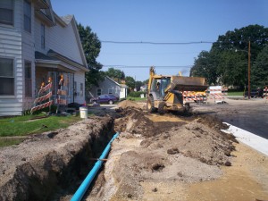
Utility locating can be a pain, but it is important to prevent damage to the utility or injury to people working near the utility. Current tools of the locating trade can include a map on a laptop or on paper, locating devices for accurately pinpointing the utility location, shovels, picks, probes, and paint or flags for marking the location in the field. The reason this task is so challenging is the need to rely on maps that many times are not accurate enough to allow the locator to just walk right up to the utility.

For example, a locator might have trouble finding a water shut off valve in someone’s yard if it is buried under snow or dirt. If there are accurate measurements to the valve, the locator uses a measuring tape and map to find the general location of the valve. And if there are not accurate measurements, which is often the case, the locator would have to randomly search the area with the locating device. Once a probable position is determined, the locator digs for the valve with a shovel. This can result in multiple holes being dug before the valve is found. If other utilities are in the area, readings can be inaccurate which makes finding the valve even harder. The whole process can be very time consuming.

Some cities have their valves in a GIS allowing the locator to walk to the approximate location with the help of a GPS device. This is very useful, but how much better and more intuitive would it be if the valve could be projected digitally onto the ground using augmented reality. The locator drives up to the site, gets out of the vehicle and puts on a headset or uses a mobile device, and all the utilities show up on the ground through the use of augmented reality.

Engineering Design:
Using this same idea, engineering design could be greatly simplified. If an engineer needs to improve a road by installing curb and gutter and a new storm sewer, maps must be collected and utilities marked in the field to designate locations of gas, electric, water, etc. Only then can the engineer determine the best place to put the curb and sewer. If all an engineer had to do was drive out to the job and use augmented reality, the best locations for the new improvements could be determined faster with more accuracy.

Engineers could also use this if a resident calls with a problem. Many times, when we respond to residents, we do not know exactly what the problem really is until we get to the site. So we might not have everything we need to determine if we can help with the problem. But if the resident had a question or problem related to a utility such as needing to tap onto our sewer or water or if they had a drainage problem and needed to tap into our storm sewer, I could not only determine right away if there was a feasible solution, but I could also show the resident by having them use the technology. Seeing the line on the ground would mean more to them than looking at a line on a map. And how much better it would be for them if we could animate the line somehow showing water flowing.

Maintenance and Construction:
Augmented reality could also be used to make sure crews are working on the right asset in the field. If we could digitally mark the manhole that needs to be fixed or the tree needing to be pruned, or the area in which I want landscaping planted, we could reduce confusion or errors in the field.

And if a contractor is installing a pipe, he could use augmented reality to see where he needs to dig. This could also assist the city in showing property owners where improvements will be made. Residents could use AR technology and actually see how the new road will look.

I could have also used AR when I was putting up the trim at my last house. This would have prevented me from drilling into a pipe or it could have helped me find the studs.

There are a lot of other uses we could figure out to help us better perform our job in public works. Hopefully this post helps generate some more ideas and maybe even challenge someone to develop an AR for public works tool.

Share