The Makeability Lab at the University of Maryland is on a mission to "collect street-level accessibility information from every street in the world and enable design and development of a novel set of location-based technologies for accessibility." In order to achieve this goal, they set up an interactive website where people can inspect, identify, and label accessibility issues along sidewalks and at curb ramps.
The accessibility issues generated by this site are fairly basic, but would still be very helpful to cities interested in quickly and easily identifying issues. Currently the site is focused on auditing infrastructure in the Washington, D.C. area.
The group also plans to use the inspection data collected to "create new types of map-based accessibility tools, such as AccessScore, an interactive map of a city's accessibility, and RouteAssist, personalized routing algorithms based on a user's reported mobility level."
In addition, they are using the labels people assign to issues to develop algorithms to allow the computer to automatically find accessibility issues in the future.
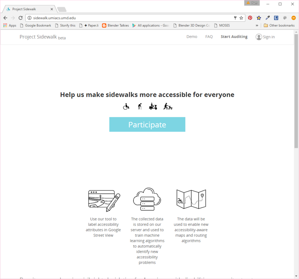
So far 218 people have inspected almost 400 miles or 37% of Washington, D.C. If you are interested in volunteering your efforts, you can visit their website at http://sidewalk.umiacs.umd.edu and click on the "Participate" button.
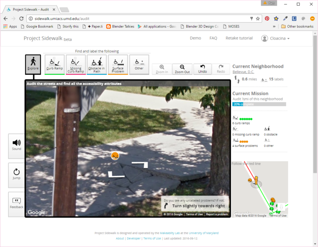
Before beginning, you'll be offered a quick tutorial. You can also create an account to track your contributions. Here are a few screenshots taken while I inspected about a half mile of sidewalk in the Bellevue neighborhood of Washington, D.C. The first shows a section of heaved and cracked sidewalk I labeled as a surface problem. You can see I was able to choose this option from the group of issue icons located above the street-view image.
When you place an icon on the image, a box pops up as shown in the screenshot below to allow you to choose the severity of the problem. The site gives some guidance on this, but there is still a lot of judgment in assigning a rating. Initially I wasn't going to give this specific problem the worst rating, but then decided the slope looks severe enough I don't think a wheelchair would safely navigate across the heaved section. Below the rating, there is a space for a more detailed description of the problem.
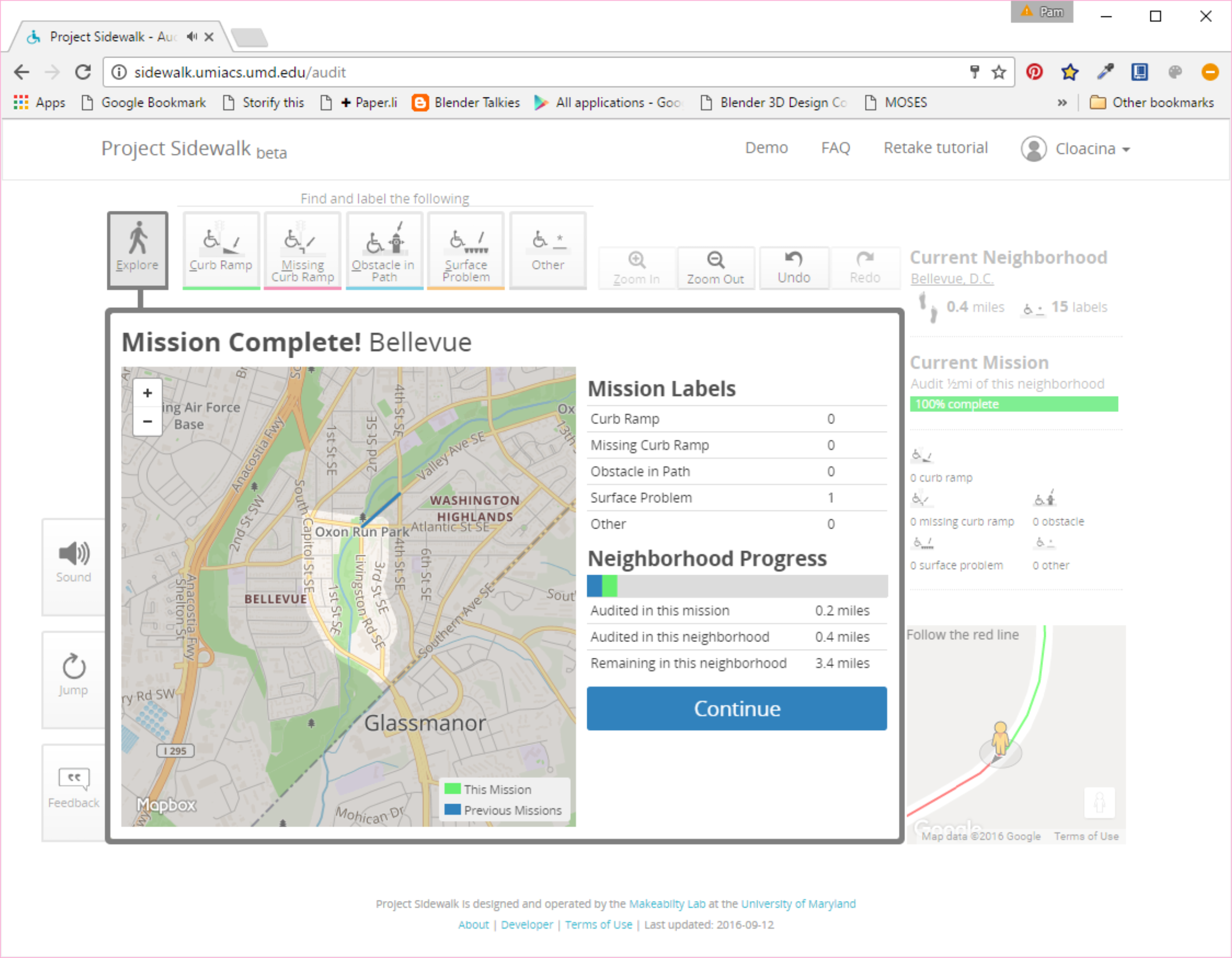
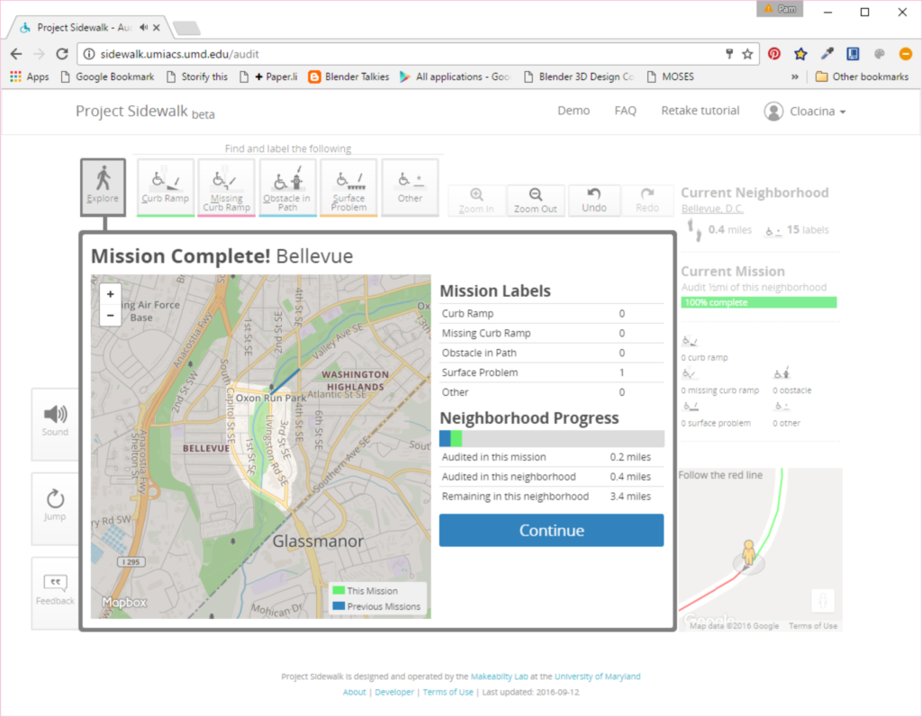
The screen also shows which neighborhood I am in, where I am at on the street, how many miles I have audited and labels I have placed. As you complete assigned sections, the site summarizes your progress as shown below:
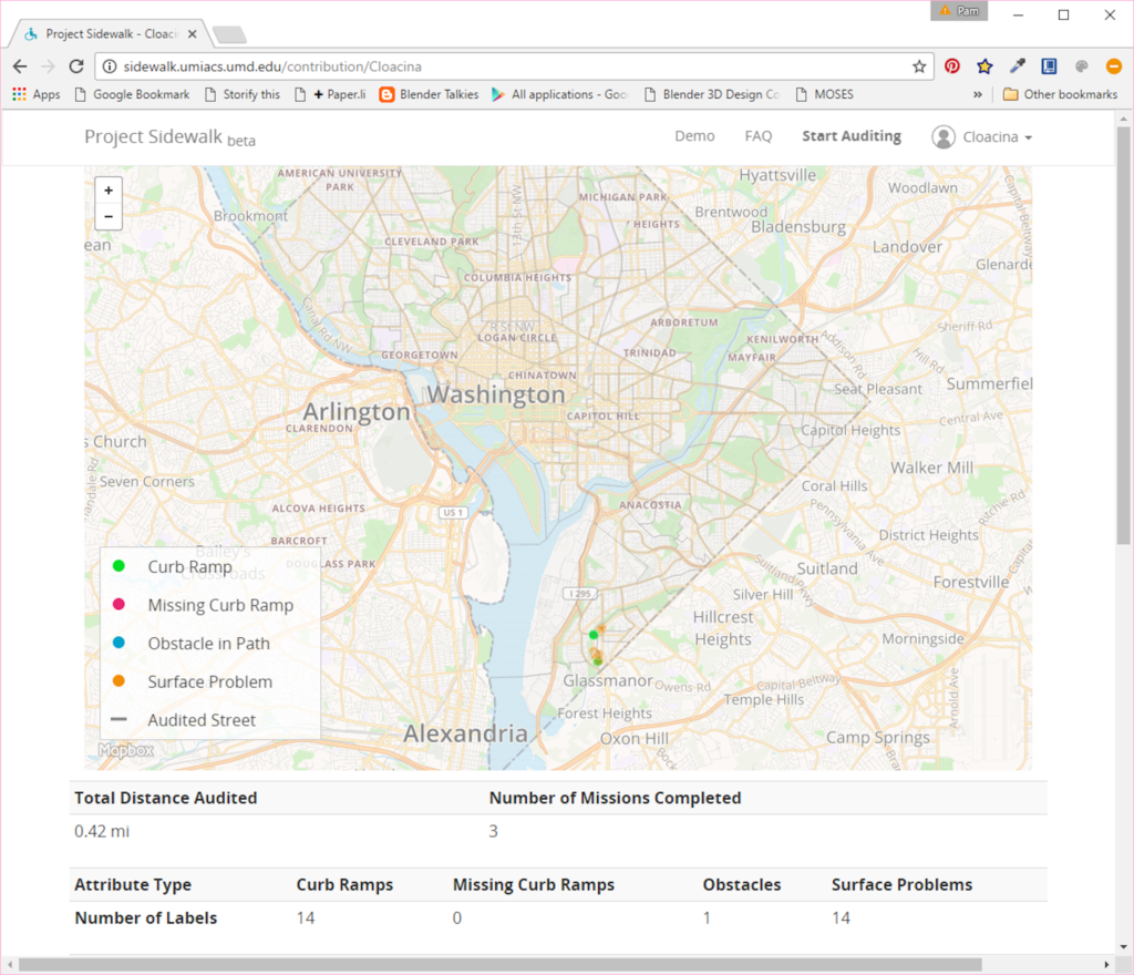
Finally, you can view your dashboard to see your overall contribution to the site. Below is my current status after only working on it for a short time:
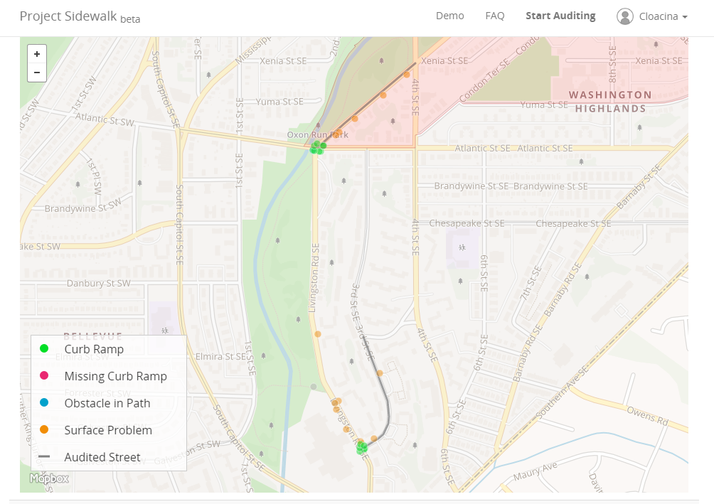
As you can see on my dashboard, the locations of the problems I found are displayed on a map. A zoomed in view of this is shown below. I was not sure if there was a way to see everyone's contributions, but if so, this would be very helpful to a city engineering or public works department in managing their sidewalk or street repair program. It would also be helpful if the data could be extracted from a given area so it could be overlaid in a city's GIS with other data such as land use, destinations such as schools and hospitals, and locations of capital improvements and developments.
Because the site is so easy to use, cities could also partner with schools and ask students to participate in inspections. This would help to engage students in their community and build awareness of the needs for and barriers to accessibility.
From what I can tell, the group also has the code for the site over on GitHub. Their license grants permission to make use of the software according the terms specified, and instructions for setting up your own development site are provided in a README file.
You can follow the group's progress through their Twitter feed: @umd_sidewalk.
