Because I am involved in cycling as both a user and as a designer, I try to make an effort to check out bicycle facilities whenever I can. Over the last month, I had the opportunity to try out the bike share program in both Denver and in Chicago. This allowed me to tour some of the bike facilities in each city and get a feel for what it is like to bike in each community. For those of you who might be interested, I've shared both experiences below. Because this was only my second time biking in Chicago and my first in Denver, I want to clarify that my viewpoint is more as someone biking for the first time in a large city. I realize people who regularly bike in Chicago and Denver would most likely have a completely different outlook on it.
Chicago Bike Share Trip
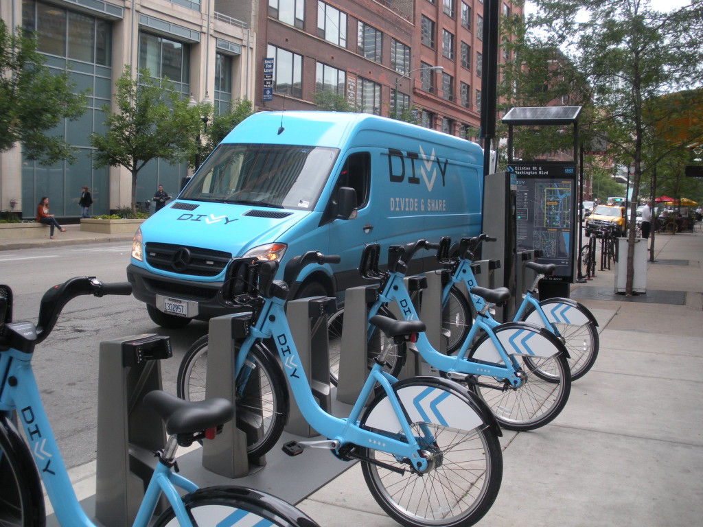
While I'd previously taken a tour of Chicago's bicycle facilities using a Divvy Bike, which is the bike share system Chicago offers, it had been as part of a large group. While that experience had been very positive, I realized that riding with a group of about 20 or more people is much different than riding alone. So I had been looking for the chance to one day try navigating the roadways by myself. My opportunity came when I was scheduled to be in Chicago for the day. I took the commuter train into Chicago to Ogilvie Station, and then used my phone to find a Divvy Station. I ended up getting a bike from the station at Madison and Halsted since I decided to ride up Halstead to my first appointment.
Checking out a bike was fairly easy. Because I am not yet a Divvy member, I needed to use my credit card to purchase a day pass. After making the payment, I received a slip of paper from the kiosk with a code. To unlock the bike I wanted, I had to punch this code into the keypad for that specific bike. This unlocked it, and I was able to pull out the bike I had chosen. Now I had 30 minutes to get to where I was going and check the bike back into another station. Fortunately the route I had chosen was easy to follow, and there was a Divvy Station at the same location where I had my first appointment. So I started to ride north on Halsted towards my destination.
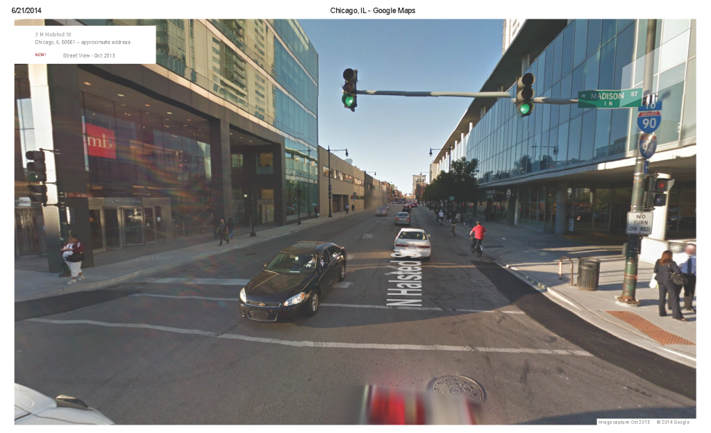
While Halsted is designated on maps and signed along the roadway as a bike route near Madison, there are no dedicated bike facilities here. So as I rode my Divvy bike north along the road, it was in the right lane along side the cars. This photo from Google Street View offers a good idea of how this layout functions.
 Right before Hubbard, I noticed construction had closed off a major portion of the right lane. Because this area is under an overpass for I-90, the lane was rather restricted so instead of swerving around the construction out into traffic more, I chose to get off the bike and cross the area of construction as a pedestrian on the sidewalk. Once I got to Hubbard, I got back onto the road and continued north. Eventually, after I crossed the river, I saw there was a dedicated bike lane for me to ride in. It was not buffered and was located between the travel lane and a parking lane which occasionally would become a right turn lane. After crossing Division, this bike lane moved to the curb line and was buffered from the travel lane. After traveling a short distance north of Division, I had to weave over to my final destination on Clybourn by riding along roads with much less traffic. When I reached Clybourn just north of Division, I checked in the Divvy Bike and went to my appointment.
My meeting at that location lasted about an hour or so, and my colleagues decided we would meet at their office in the loop to go over another topic. Rather than drive with them, another person and I decided to ride to their office so we could continue to check out the bike facilities. So I picked up another Divvy Bike by putting my credit card in the kiosk, getting the paper with the code, and typing it into the keypad. We rode south from Clybourn, along Division east, then south on Orleans eventually winding our way over to Wells which started out as a two-way street then turned into a one-way street running south. There was a dedicated bike lane along Wells from where we entered down to just south of Hubbard. This lane was located between the vehicle lane and a parking lane and was sometimes buffered on the parking side and other times on the vehicle side. As we got down into the Loop, or as my riding partner said, "the belly of the beast," we ended up in a shared lane marked by sharrows. Our final destination was near Wacker and Monroe so I dropped off the Divvy Bike at a station on Franklin just south of Madison. And because the rest of our day was to be spent near this location, we walked to the remainder of our appointments.
The Chicago Experience
Overall, my experience that day riding a bike in Chicago was positive. It had been very easy to find a Divvy Station, the stations were conveniently located in areas where I needed to go, and there were a wide variety of well-connected biking facilities that I could easily locate through the use of Google maps and signage along the routes. Also, I felt very comfortable as a rider. The drivers of vehicles were very respectful and gave me plenty of room. This was even during my morning ride which was between 7:30 am and 8:00 am – a time that would be considered "rush hour" in this area. I also felt safe and comfortable riding in a shared lane in the Loop where there are many pedestrians and many different types of vehicles.
A few additional thoughts I had from that trip were the following:
- It would be helpful to have some easy way to track my time on the Divvy Bike without having to remember exactly when I picked up the bike and then check my phone constantly for the time.
- I noticed that if a station is on a one-way street, you really can only pick up a bike there if you are going to travel in that same direction. I realize some people bike in the opposite direction to traffic, but that is not encouraged. From what I understand a cyclist should try to bike in the same direction as the vehicles.
- Although I didn't have too much trouble finding a station, I wish there was a very easy way to locate them instead of having to zoom to a map on my phone.
- The absolute worst part of the entire experience was dealing with the surface on Halsted. It was full of potholes and in very bad shape which made riding not only uncomfortable, but unsafe since I had to constantly swerve around the holes.
- The Google map showing the bike facilities is extremely helpful.
- I definitely want to go back and try biking some more in Chicago!
Denver Bike Share Trip
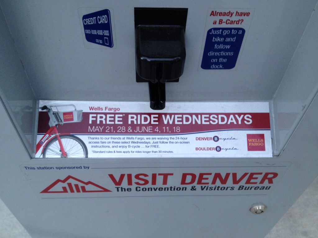
In order to try out biking in Denver, I had to go early in the morning in order to fit it into my day. So my trip started at 5:30 am and ended at 6:30 am which was not really a time I would consider to be facing true "rush hour" traffic. Like Chicago, Denver has a great bike share system called B-cycle. Checking out the bike was super easy. I just had to put in my credit card and tell the machine which bike I was taking. Also, I saw a sign saying Wednesdays were free so since I was checking it out on Wednesday, I think I might have been able to ride for free that day. (I haven't yet gotten my credit card statement so can't yet verify if that was the case or not.)
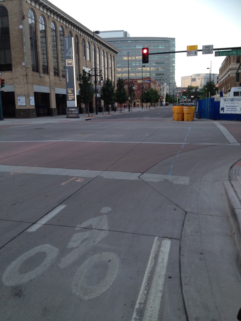
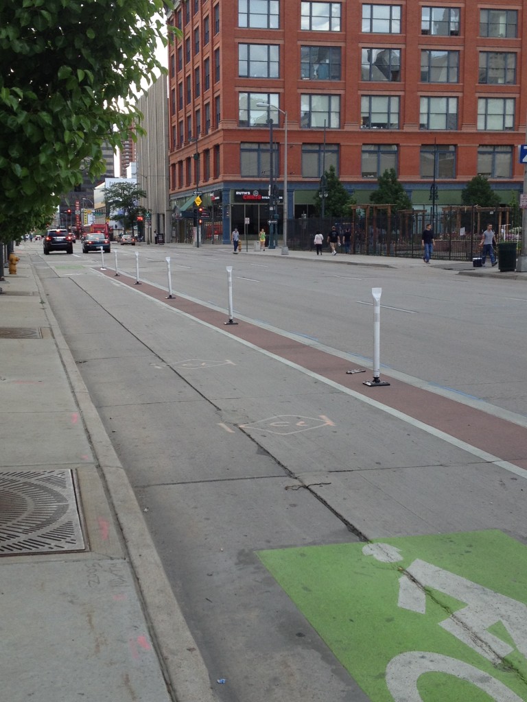
It had also been easy to locate a station at 14th and Welton near my hotel and the Convention Center. And by picking up a bike here, I could get onto 14th street which ran one-way to the southeast in the direction I needed to go. I rode in a dedicated bike lane on 14th that was located intermittently between either the vehicle lane and the curb or the vehicle lane and a parking lane. There was at one point construction blocking the bike lane, but because there were so few cars I could easily move out into the vehicle lane around the barricades.
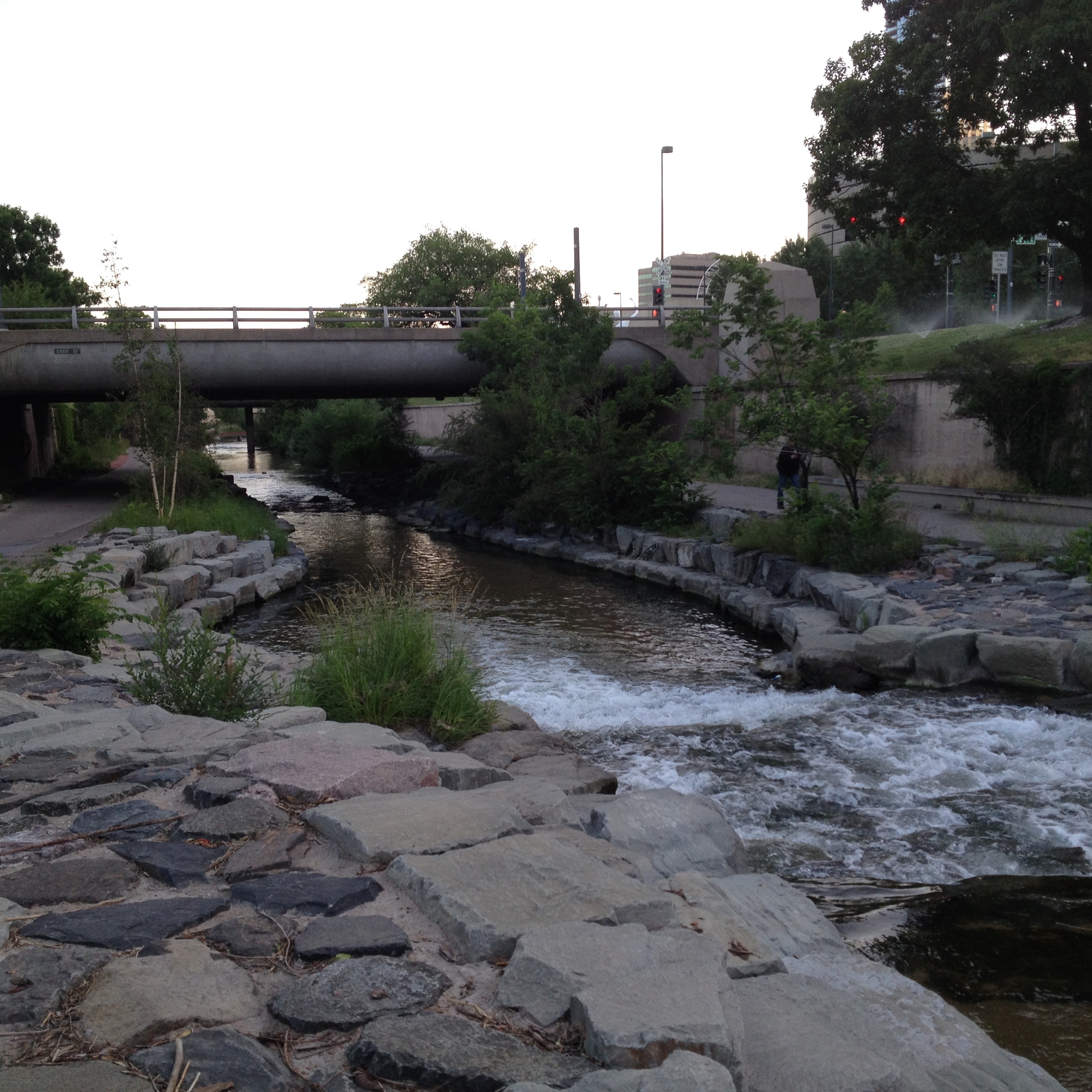
I rode along 14th to Bannock then took Bannock south to Speer. There was a dedicated bike lane along Bannock that was similar to the one along 14th. Again, I experienced little traffic. The problem was when I got to Speer I wanted to get onto the Cherry Creek Trail which is an off-road facility. There were no signs directing me to the trail, and I quickly realized it was below the roadway so I needed to find a way to get down there. As I crossed the bridge on Bannock over the trail I noticed there seemed to be a path down to the trail further to the west along Speer, but because Speer was busy by now with traffic, and there were no bike facilities, I decided to just take the sidewalk along the west side of Speer to this connection. Other than having to walk this distance, the other problem was that there were sprinklers spraying water onto the sidewalk so I had to wait until they changed direction before I could begin walking.
Once I got onto the trail, I rode north. It seemed to be a great facility with nice views of the creek, and I saw a lot of cyclists who appeared to be using it to most likely commute to work. I had to be careful though because they were riding at a high rate of speed and not all of them would announce they were passing. There was also one point where the trail split and one direction was only for pedestrians and the other for bicyclists. This was not well marked so I had inadvertently started down the pedestrian one a short distance before seeing a painted symbol on the ground telling me I wasn't allowed to go that way. After going back to the split, I continued on and went up a connection to get back to Speer at Arapahoe. There really were no facilities here and Speer was again very busy at this location so I did feel uncomfortable riding in this area. I rode north on Arapahoe back across the creek and up to 14th Street. Once I got to 14th, I could enter the dedicated bike lane there and return to the Convention Center where I checked the bike back in and then back out again.
Because it was only 6 am at this point, I decided to try to ride again along 14th, but this time try to visit the Botanic Gardens. Looking back at the map now, I realize I probably should have ridden to Bannock and then across 12th Street which is listed as a "bicycle friendly road" on Google. But I wanted to try to go across 16th since it had a dedicated bike lane. This is where the whole trip fell apart. I rode again along 14th but instead of going to Bannock, I somehow got mixed up in the area of the Capitol where all the roads converge and ended up on Colfax. Because I was worried about the 30-minute time limit on the bike, I ended up going to the bike station at Sherman and 16th to exchange bikes. But even though I was finally on 16th, by now I realized I would have little time left to make it to the Botanic Gardens. Unfortunately I also could not see a good way to get back to the Convention Center from here. So because 16th was one-way in the opposite direction I needed to go, I rode back to Colfax then over to Lincoln and north along Lincoln which turned out to be a very busy road with little to no room for bikes. I was extremely uncomfortable riding here because the vehicles rode very close to me as if I was not even there.
Fortunately when I got to 18th Street, I recognized the area from previous walks I had taken and knew I could turn southerly on 18th and make my way back. So I only had to endure one more block of no bike facilities along 18th until I could get to Tremont which had a dedicated lane. I then took Tremont until I reached 15th, then rode in the dedicated lane on this one-way street until I found a street leading back to 14th near the Convention Center where I could return the bike to the station.
The Denver Experience
Overall, I am very happy I cycled through Denver, particularly in the downtown area on a variety of bike facilities. The main thing I learned by doing so was that you can have incredible facilities, but the cycling experience can still be very poor. I have to think the reasons I was so uncomfortable biking in Denver was due to a lack of directional signage, drivers that rode too close to me, missing connections between bicycle-friendly roads and trails forcing me onto busy roads with little to no room for bikes, and way too many one-way streets that were not always laid out in a grid pattern making simple navigation confusing and difficult. As a designer, I think this is really important to keep in mind because it shows the biking experience is not solely dependent on the type or design of the facility.
I also wanted to share that my outlook seemed to match that of a young gentleman I had spoken with my first day in Denver. He had been my waiter at the restaurant where I chose to eat lunch, and when he sat down to chat with me, I had taken the opportunity to ask him about biking in Denver. He told me he was originally from Minnesota which he believed to be a great place to bike. He said biking in Denver was not as comfortable. His opinion was that the drivers there are not as courteous with the cyclists as they are in Minnesota. This is definitely the same impression I had gotten in just the short time I biked through the downtown.
Here are some final thoughts, comments, and advice on biking as a visitor in Denver:
- Avoid the Capitol area.
- Spend a lot of time before your trip planning your route – if you don't and are downtown you risk getting lost or confused by all the one-way streets and grid patterns that are set at different angles to each other.
- If you are using the bike share system, pick out the station where you will exchange bikes. If B-cycle offered some way to map out a 30-minute riding perimeter around the station where you picked up a bike, it would help to know which station you should try to drop it off at.
- I wish there was some way to easily find the B-cycle stations without having to constantly check my phone.
- I wish there had been more directional signage or better maps to help cyclists find the best connections between all these facilities. I tried using the city's online map, but it was so hard to see and navigate around on a small phone screen.
- I'd recommend not riding at rush hour if it's your first time riding in Denver.
- The Google map showing the bike facilities is extremely helpful.
- I definitely want to go back and try biking some more in Denver – maybe this time along the river trail!
